Trail Mountain bike Saint-Front-sur-Lémance - lastreilles - Photo
© OpenStreetMap contributors
Length
Length
31 km
Max alt
Max alt
269 m
Uphill gradient
Uphill gradient
592 m
Km-Effort
Km-Effort  
38 km
Min alt
Min alt
105 m
Downhill gradient
Downhill gradient
589 m
Boucle
Boucle
Yes
Creation date :
2014-12-10 00:00:00.0
Updated on :
2014-12-10 00:00:00.0

(0 Reviews)

Mountain bike
Mountain bike
2h53
Difficulty : Medium

Scan this QR Code to open this trail in the SityTrail application

FREE GPS app for hiking

Logo SityTrail SityTrail

IGN / Geographical institutes

Download SityTrail from the App Store Download SityTrail from Google Play

Logo SityTrail SityTrail World

The world is yours!

Download SityTrail from the App Store Download SityTrail from Google Play Download SityTrail on Huawei AppGallery

About

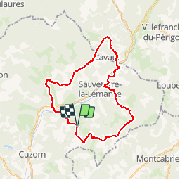
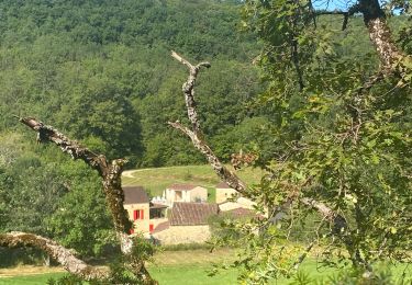
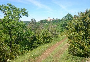
Trail Mountain bike of 31 km to be discovered at New Aquitaine, Lot-et-Garonne, Saint-Front-sur-Lémance. This trail is proposed by franck47500.

Elevation profile

Positioning

Country:
France
Region :
New Aquitaine
Department/Province :
Lot-et-Garonne
Municipality :
Saint-Front-sur-Lémance
Location:
Unknown
Start:(UTM)
340707 ; 4936481 (31T) N.

Trails nearby

Trail Walking Saint-Front-sur-Lémance - La randonnée de Bonaguil -Balisage jaune  - Photo
Walking
alainjoseph6

Walking

Medium
Saint-Front-sur-Lémance, New Aquitaine, Lot-et-Garonne, France
8.1 km | 10.4 km-effort
2h 49min
Yes
Trail Walking Saint-Front-sur-Lémance - boucle bonaguil via lastreilles - Photo
Walking
fab0202

Walking

Easy
Saint-Front-sur-Lémance, New Aquitaine, Lot-et-Garonne, France
16.1 km | 21 km-effort
4h 9min
Yes
Trail Mountain bike Saint-Front-sur-Lémance - Bonaguil, sur le GR® 36, entre Périgord et Quercy - Photo
Mountain bike
tracegps

Mountain bike

Medium
Saint-Front-sur-Lémance, New Aquitaine, Lot-et-Garonne, France
9.3 km | 12.3 km-effort
1h 10min
Yes
Trail Walking Saint-Front-sur-Lémance - Bonaguil, sur le GR® 36, entre Périgord et Quercy - Photo
Walking
tracegps

Walking

Medium
Saint-Front-sur-Lémance, New Aquitaine, Lot-et-Garonne, France
9.3 km | 12.3 km-effort
3h 0min
Yes
Trail Walking Cuzorn - tuc blanc - Photo
Walking
adgjm

Walking

Very easy
(1)
Cuzorn, New Aquitaine, Lot-et-Garonne, France
7.6 km | 9.3 km-effort
2h 44min
No
Trail Mountain bike Saint-Front-sur-Lémance - Saint Front sur Lémance  - Photo
Mountain bike
tracegps

Mountain bike

Medium
Saint-Front-sur-Lémance, New Aquitaine, Lot-et-Garonne, France
29 km | 36 km-effort
2h 30min
Yes
Trail Walking Sauveterre-la-Lémance - Autour de Sauveterre la lemance  - Photo
Walking
Thierry Hrn

Walking

Medium
Sauveterre-la-Lémance, New Aquitaine, Lot-et-Garonne, France
44 km | 51 km-effort
3h 0min
No
Trail Walking Sauveterre-la-Lémance - sauveterroise - Photo
Walking
franck47500

Walking

Medium
Sauveterre-la-Lémance, New Aquitaine, Lot-et-Garonne, France
7.8 km | 9.6 km-effort
3h 46min
Yes
Trail Mountain bike Saint-Front-sur-Lémance - Saint Front sur Lémance - Biron - Photo
Mountain bike
tracegps

Mountain bike

Difficult
(1)
Saint-Front-sur-Lémance, New Aquitaine, Lot-et-Garonne, France
46 km | 56 km-effort
3h 30min
Yes


Close
My subscriptions