Trail On foot Thorigny-sur-Marne - Thorigny-Dampmart-Chessy - Photo
 Surot
Surot

User

© OpenStreetMap contributors
Length
Length
15.3 km
Max alt
Max alt
129 m
Uphill gradient
Uphill gradient
226 m
Km-Effort
Km-Effort  
18.3 km
Min alt
Min alt
38 m
Downhill gradient
Downhill gradient
228 m
Boucle
Boucle
Yes
Creation date :
2019-06-09 19:45:21.612
Updated on :
2019-06-09 19:57:51.959

(0 Reviews)

On foot
On foot
4h10
Difficulty : Medium

Scan this QR Code to open this trail in the SityTrail application

FREE GPS app for hiking

Logo SityTrail SityTrail

IGN / Geographical institutes

Download SityTrail from the App Store Download SityTrail from Google Play

Logo SityTrail SityTrail World

The world is yours!

Download SityTrail from the App Store Download SityTrail from Google Play Download SityTrail on Huawei AppGallery

About

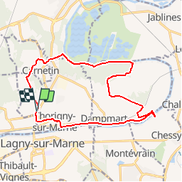
Trail On foot of 15.3 km to be discovered at Ile-de-France, Seine-et-Marne, Thorigny-sur-Marne. This trail is proposed by Surot.

Description

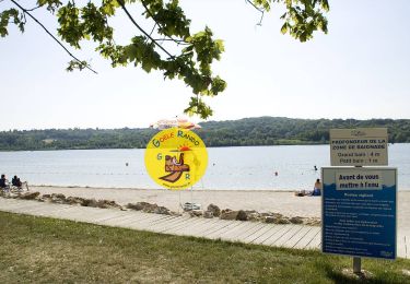
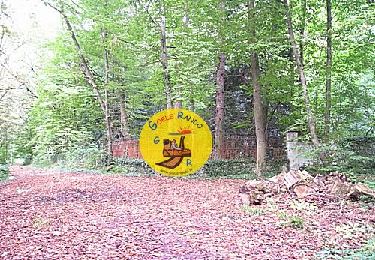
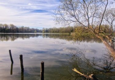
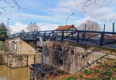
Boucle de 15 km assez facile malgré qq dénivelés un peu raides mais courts en 2-3 endroits, on traverse des villages, des champs, des bois,on longe les bords de Marne en 2 endroits, on passe sur l'aqueduc enfoui de la Dhuys, sur la passerelle remise en place en 2018 sur la Marne pour aller voir les sculptures  faites avec les pierres de l'ancien pont détruit par les Allemands en 44, puis retour vers Thorigny devant ses qq belles villas , sa fontaine et son église Saint Martin et ce qui reste de son ancienne abbaye

Elevation profile

Positioning

Country:
France
Region :
Ile-de-France
Department/Province :
Seine-et-Marne
Municipality :
Thorigny-sur-Marne
Location:
Unknown
Start:(UTM)
478259 ; 5414985 (31U) N.

Trails nearby

Trail Walking Jablines - SM_JABLINES_7.4Km - Photo
Walking
GR77LP

Walking

Medium
(7)
Jablines, Ile-de-France, Seine-et-Marne, France
7.4 km | 8 km-effort
1h 49min
Yes
Trail Walking Dampmart - SM_DAMPMART-EST_8.1Km - Photo
Walking
GR77LP

Walking

Medium
(3)
Dampmart, Ile-de-France, Seine-et-Marne, France
8.1 km | 9.5 km-effort
2h 9min
Yes
Trail Walking Dampmart - ASAM Dampmart La Dhuys - Photo
Walking
PatCant

Walking

Easy
(1)
Dampmart, Ile-de-France, Seine-et-Marne, France
4.5 km | 5.4 km-effort
1h 13min
Yes
Trail Walking Saint-Thibault-des-Vignes - Du Parc de Rentilly au Vallon de la Brosse - Photo
Walking

Walking

Medium
(4)
Saint-Thibault-des-Vignes, Ile-de-France, Seine-et-Marne, France
9.8 km | 11.3 km-effort
2h 33min
Yes
Trail On foot Bussy-Saint-Georges - Du Parc de Rentilly au Vallon de la Brosse - Photo
On foot

On foot

Very easy
(1)
Bussy-Saint-Georges, Ile-de-France, Seine-et-Marne, France
5 km | 5.8 km-effort
1h 55min
Yes
Trail Walking Dampmart - Dampmart Grand Parcours - Photo
Walking
CC.RIDER

Walking

Easy
(1)
Dampmart, Ile-de-France, Seine-et-Marne, France
19.5 km | 24 km-effort
5h 9min
Yes
Trail Walking Gouvernes - Vallée de la Brosse - Photo
Walking
PatRando

Walking

Easy
(1)
Gouvernes, Ile-de-France, Seine-et-Marne, France
7.9 km | 9 km-effort
1h 59min
No
Trail Walking Bussy-Saint-Georges - Boucle Rentilly - Noisiel - Etang de la Brosse - Etang de la Loy - Photo
Walking
chessyca

Walking

Very difficult
Bussy-Saint-Georges, Ile-de-France, Seine-et-Marne, France
25 km | 29 km-effort
6h 32min
Yes
Trail Walking Vaires-sur-Marne - Boucle Vaires sur Marne / Noisiel / Chelles - Photo
Walking
chessyca

Walking

Easy
Vaires-sur-Marne, Ile-de-France, Seine-et-Marne, France
21 km | 24 km-effort
4h 33min
Yes


Close
My subscriptions