Trail Cycle Tarascon - Activity - Photo

Pour tout ceux qui veulent voyager en Europe à vélo GUIDE+

© OpenStreetMap contributors
Length
Length
39 km
Max alt
Max alt
74 m
Uphill gradient
Uphill gradient
230 m
Km-Effort
Km-Effort  
41 km
Min alt
Min alt
3 m
Downhill gradient
Downhill gradient
171 m
Boucle
Boucle
No
Creation date :
2019-06-10 09:02:25.661
Updated on :
2019-06-10 09:03:24.117

(0 Reviews)

Cycle
Cycle
--
Difficulty : Difficult

Scan this QR Code to open this trail in the SityTrail application

FREE GPS app for hiking

Logo SityTrail SityTrail

IGN / Geographical institutes

Download SityTrail from the App Store Download SityTrail from Google Play

Logo SityTrail SityTrail World

The world is yours!

Download SityTrail from the App Store Download SityTrail from Google Play Download SityTrail on Huawei AppGallery

About

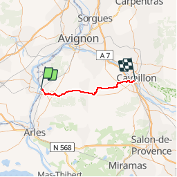
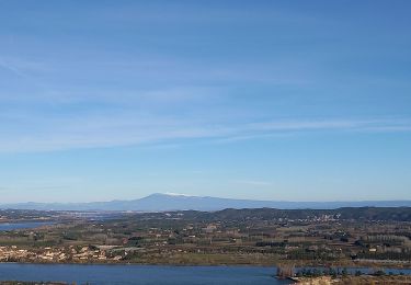
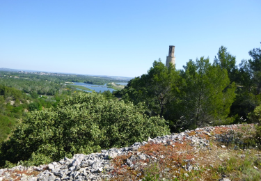
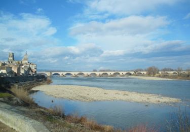
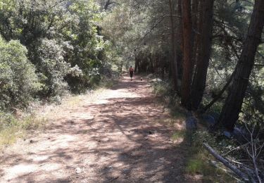
Trail Cycle of 39 km to be discovered at Provence-Alpes-Côte d'Azur, Bouches-du-Rhône, Tarascon. This trail is proposed by EuroVelo 8.

Description

Eurovelo 8 - Beaucaire-tarascon-Cavaillon

Elevation profile

Positioning

Country:
France
Region :
Provence-Alpes-Côte d'Azur
Department/Province :
Bouches-du-Rhône
Municipality :
Tarascon
Location:
Unknown
Start:(UTM)
633470 ; 4851200 (31T) N.

Trails nearby

Trail Walking Comps - Abbaye de St-Roman - Photo
Walking
Amaralain

Walking

Easy
(1)
Comps, Occitania, Gard, France
5 km | 6.8 km-effort
1h 27min
Yes
Trail Walking Tarascon - Chapelle Saint Gabriel - Photo
Walking
GUIDE
Roger Philippe Wallez

Walking

Very difficult
Tarascon, Provence-Alpes-Côte d'Azur, Bouches-du-Rhône, France
18.6 km | 25 km-effort
5h 23min
Yes
Trail Walking Tarascon - CR_Domitia_BA_23_Tarascon_St-Remy-Provence_20220404 - Photo
Walking
patrickdanilo

Walking

Medium
Tarascon, Provence-Alpes-Côte d'Azur, Bouches-du-Rhône, France
17 km | 22 km-effort
4h 42min
No
Trail Hybrid bike Comps - Voie verte depuis barrage de Vallabrègues Intersport Marguillier Saint Félix et fin au château de Beaucaire  - Photo
Hybrid bike
jacqk

Hybrid bike

Easy
Comps, Occitania, Gard, France
9.1 km | 10.4 km-effort
1h 0min
No
Trail Walking Beaucaire - Beaucaire/ St Roman - Photo
Walking
GUIDE
nadinebondoux

Walking

Easy
Beaucaire, Occitania, Gard, France
14.7 km | 18.6 km-effort
3h 42min
Yes
Trail On foot Beaucaire - La Bouteille - Photo
On foot
Michele.nigri

On foot

Easy
Beaucaire, Occitania, Gard, France
14.6 km | 18.1 km-effort
Unknown
Yes
Trail Cycle Tarascon - Via Rhôna de Tarascon à bourg-saint-andéol  - Photo
Cycle
destras

Cycle

Easy
Tarascon, Provence-Alpes-Côte d'Azur, Bouches-du-Rhône, France
108 km | 118 km-effort
6h 46min
No
Trail Walking Tarascon - Alpilles Ouest - St-Gabriel - Photo
Walking
tracegps

Walking

Medium
Tarascon, Provence-Alpes-Côte d'Azur, Bouches-du-Rhône, France
8.2 km | 11 km-effort
2h 30min
Yes
Trail Walking Tarascon - alpilles chapelle saint gabriel - Photo
Walking
Dan30

Walking

Easy
Tarascon, Provence-Alpes-Côte d'Azur, Bouches-du-Rhône, France
13.1 km | 18.2 km-effort
3h 26min
Yes


Close
My subscriptions