Trail Walking Vauxrenard - vauxrenard - Photo
 Zeugma13
Zeugma13

User

© OpenStreetMap contributors
Length
Length
21 km
Max alt
Max alt
802 m
Uphill gradient
Uphill gradient
774 m
Km-Effort
Km-Effort  
31 km
Min alt
Min alt
387 m
Downhill gradient
Downhill gradient
782 m
Boucle
Boucle
Yes
Creation date :
2014-12-10 00:00:00.0
Updated on :
2014-12-10 00:00:00.0

(1 Reviews)

Walking
Walking
5h07
Difficulty : Difficult

Scan this QR Code to open this trail in the SityTrail application

FREE GPS app for hiking

Logo SityTrail SityTrail

IGN / Geographical institutes

Download SityTrail from the App Store Download SityTrail from Google Play

Logo SityTrail SityTrail World

The world is yours!

Download SityTrail from the App Store Download SityTrail from Google Play Download SityTrail on Huawei AppGallery

About

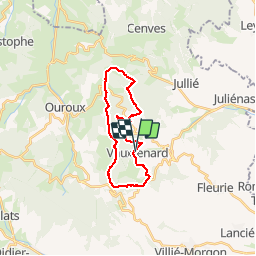
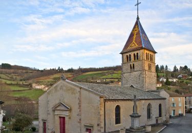
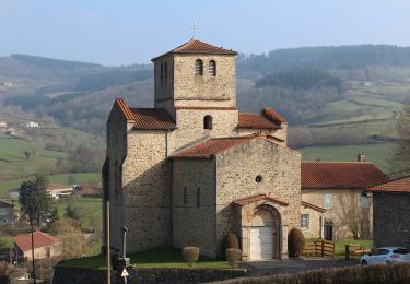
Trail Walking of 21 km to be discovered at Auvergne-Rhône-Alpes, Rhône, Vauxrenard. This trail is proposed by Zeugma13.

Elevation profile

Positioning

Country:
France
Region :
Auvergne-Rhône-Alpes
Department/Province :
Rhône
Municipality :
Vauxrenard
Location:
Unknown
Start:(UTM)
626734 ; 5118623 (31T) N.

Comments

Please log in to post a review or rate the element


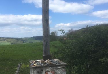
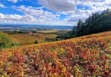
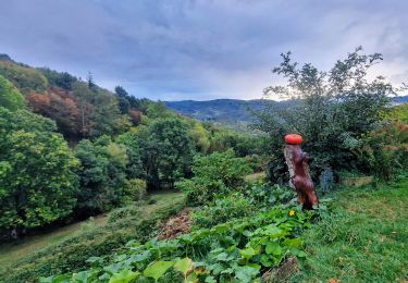
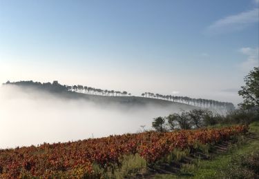
Une randonnée avec un fort dénivelé qui la rend assez technique.Traversée de nombreux paysages et terrains avec de magnifiques points de vue sur le Beaujolais.Attention à se munir d'une carte, le balisage sur les derniers kilomètres est parfois inexistant.


Trails nearby

Trail Walking Deux-Grosnes - Ouroux - Photo
Walking
Galoche

Walking

Difficult
(1)
Deux-Grosnes, Auvergne-Rhône-Alpes, Rhône, France
19.1 km | 0 m-effort
5h 57min
Yes
Trail Walking Vauxrenard - Itinérant Beaujolais rouge étape 6 Foretal - Macon gare TGV - Photo
Walking
chessyca

Walking

Very difficult
Vauxrenard, Auvergne-Rhône-Alpes, Rhône, France
23 km | 28 km-effort
6h 26min
No
Trail Walking Chiroubles - Itinérant Beaujolais rouge étape 5 Chiroubles- Foretal - Photo
Walking
chessyca

Walking

Medium
Chiroubles, Auvergne-Rhône-Alpes, Rhône, France
23 km | 32 km-effort
5h 44min
No
Trail Walking Beaujeu - Itinérant Beaujolais rouge étape 4 . Malval - Chiroubles - Photo
Walking
chessyca

Walking

Medium
Beaujeu, Auvergne-Rhône-Alpes, Rhône, France
26 km | 34 km-effort
5h 40min
No
Trail Walking Chiroubles - 2023-05-26_00h30m21_28127-15675317-2 (2) - Photo
Walking
daniellebou

Walking

Very difficult
(1)
Chiroubles, Auvergne-Rhône-Alpes, Rhône, France
16.9 km | 26 km-effort
5h 49min
Yes
Trail On foot Deux-Grosnes - Circuit des Sapins - Photo
On foot
PRO

On foot

Difficult
Deux-Grosnes, Auvergne-Rhône-Alpes, Rhône, France
22 km | 33 km-effort
7h 34min
Yes
Trail On foot Deux-Grosnes - Circuit du Bois du Thym - Photo
On foot
PRO

On foot

Easy
Deux-Grosnes, Auvergne-Rhône-Alpes, Rhône, France
6.8 km | 10.6 km-effort
2h 24min
Yes
Trail Walking Fleurie - Fleurie (Rhône) 17 km - D. 498 m - Photo
Walking
Thomasdanielle

Walking

Medium
Fleurie, Auvergne-Rhône-Alpes, Rhône, France
16.7 km | 23 km-effort
5h 25min
Yes
Trail Walking Fleurie - les vignes de Fleurie - Photo
Walking
reneperrin

Walking

Easy
Fleurie, Auvergne-Rhône-Alpes, Rhône, France
8.1 km | 10.8 km-effort
2h 1min
Yes


Close
My subscriptions