Trail Walking Marcillac-la-Croisille - Grand circuit des jardins de Bardot  - Photo

Grand circuit des jardins de Bardot

 viam19
viam19

User

© OpenStreetMap contributors
Length
Length
14.6 km
Max alt
Max alt
550 m
Uphill gradient
Uphill gradient
559 m
Km-Effort
Km-Effort  
22 km
Min alt
Min alt
265 m
Downhill gradient
Downhill gradient
556 m
Boucle
Boucle
Yes
Creation date :
2019-06-16 08:07:17.501
Updated on :
2019-06-17 09:19:38.439

(0 Reviews)

Walking
Walking
6h42
Difficulty : Medium

Scan this QR Code to open this trail in the SityTrail application

FREE GPS app for hiking

Logo SityTrail SityTrail

IGN / Geographical institutes

Download SityTrail from the App Store Download SityTrail from Google Play

Logo SityTrail SityTrail World

The world is yours!

Download SityTrail from the App Store Download SityTrail from Google Play Download SityTrail on Huawei AppGallery

About

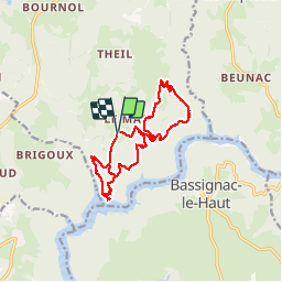
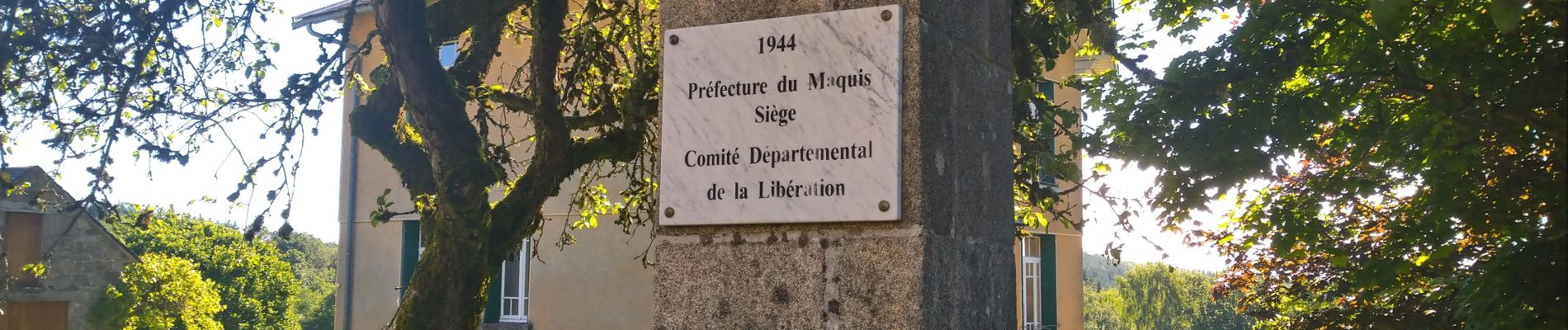
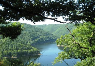
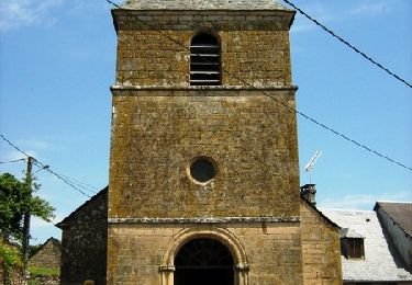
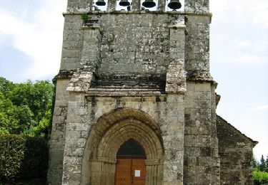
Trail Walking of 14.6 km to be discovered at New Aquitaine, Corrèze, Marcillac-la-Croisille. This trail is proposed by viam19.

Description

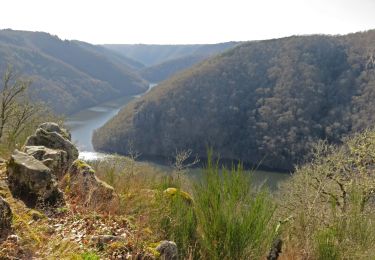
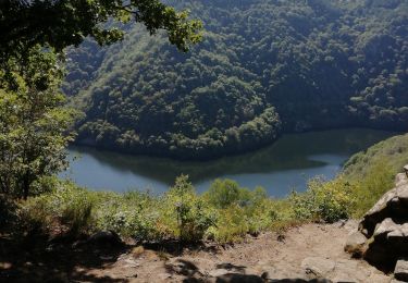
Circuit de 14,59 km incluant la descente du circuit le long du ruisseau des Agaries et le circuit des jardins de Bardot ainsi qu'un passage sur le plateau avec vues sur la Dordogne et sur les Monts du Cantal.
La descente sur les jardins de Bardot demande une forte attention.

Elevation profile

Photos

Positioning

Country:
France
Region :
New Aquitaine
Department/Province :
Corrèze
Municipality :
Marcillac-la-Croisille
Location:
Unknown
Start:(UTM)
425076 ; 5008407 (31T) N.

Trails nearby

Trail Mountain bike Marcillac-la-Croisille - Le Jardin de Bardot - Marcillac la Croisille - Pays d'Égletons - Photo
Mountain bike
tracegps

Mountain bike

Medium
(1)
Marcillac-la-Croisille, New Aquitaine, Corrèze, France
3.6 km | 6 km-effort
30min
Yes
Trail Walking Marcillac-la-Croisille - Les Agaries - Marcillac la Croisille - Pays d'Égletons - Photo
Walking
tracegps

Walking

Easy
(1)
Marcillac-la-Croisille, New Aquitaine, Corrèze, France
2.7 km | 4.5 km-effort
45min
Yes
Trail Walking Gros-Chastang - Observatoires des cerfs - Photo
Walking
viam19

Walking

Easy
Gros-Chastang, New Aquitaine, Corrèze, France
7.4 km | 8.5 km-effort
3h 11min
Yes
Trail Walking Bassignac-le-Haut - 157 TraceGps issued - Photo
Walking
houbart

Walking

Difficult
(1)
Bassignac-le-Haut, New Aquitaine, Corrèze, France
11.9 km | 18.2 km-effort
4h 8min
Yes
Trail Walking Marcillac-la-Croisille - Le jardin de Bardot - Photo
Walking
arnoultjf

Walking

Very easy
Marcillac-la-Croisille, New Aquitaine, Corrèze, France
3.8 km | 6.6 km-effort
1h 58min
Yes
Trail Mountain bike Saint-Merd-de-Lapleau - Le Pont de Gire - Saint Merd de Lapleau - Pays d'Egletons  - Photo
Mountain bike
tracegps

Mountain bike

Medium
Saint-Merd-de-Lapleau, New Aquitaine, Corrèze, France
10.5 km | 14 km-effort
45min
Yes
Trail Walking Saint-Merd-de-Lapleau - Le Pont de Gire - Saint Merd de Lapleau - Pays d'Egletons  - Photo
Walking
tracegps

Walking

Medium
Saint-Merd-de-Lapleau, New Aquitaine, Corrèze, France
10.5 km | 14 km-effort
3h 0min
Yes
Trail Walking Marcillac-la-Croisille - Le Jardin de Bardot - Marcillac la Croisille - Pays d'Égletons - Photo
Walking
tracegps

Walking

Difficult
Marcillac-la-Croisille, New Aquitaine, Corrèze, France
3.6 km | 6 km-effort
1h 30min
Yes
Trail Walking Marcillac-la-Croisille - Marcillac Les 2 ponts du lac et Bos Redons - Photo
Walking
grageot

Walking

Easy
(1)
Marcillac-la-Croisille, New Aquitaine, Corrèze, France
16.2 km | 20 km-effort
4h 17min
Yes


Close
My subscriptions