Trail Walking Comps - comps col de vesc chabrier projet pb - Photo

comps col de vesc chabrier projet pb

© OpenStreetMap contributors
Length
Length
9 km
Max alt
Max alt
808 m
Uphill gradient
Uphill gradient
281 m
Km-Effort
Km-Effort  
12.8 km
Min alt
Min alt
602 m
Downhill gradient
Downhill gradient
284 m
Boucle
Boucle
Yes
Creation date :
2014-12-10 00:00:00.0
Updated on :
2014-12-10 00:00:00.0

(1 Reviews)

Walking
Walking
2h53
Difficulty : Easy

Scan this QR Code to open this trail in the SityTrail application

FREE GPS app for hiking

Logo SityTrail SityTrail

IGN / Geographical institutes

Download SityTrail from the App Store Download SityTrail from Google Play

Logo SityTrail SityTrail World

The world is yours!

Download SityTrail from the App Store Download SityTrail from Google Play Download SityTrail on Huawei AppGallery

About

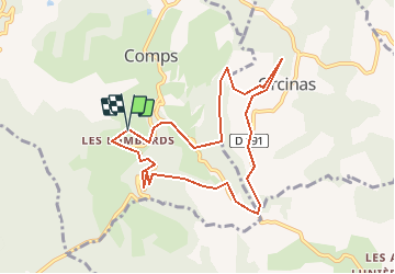
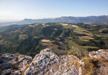
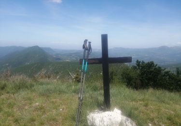
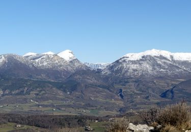
Trail Walking of 9 km to be discovered at Auvergne-Rhône-Alpes, Drôme, Comps. This trail is proposed by philippebrondel.

Elevation profile

Positioning

Country:
France
Region :
Auvergne-Rhône-Alpes
Department/Province :
Drôme
Municipality :
Comps
Location:
Unknown
Start:(UTM)
667476 ; 4934451 (31T) N.

Comments

Please log in to post a review or rate the element


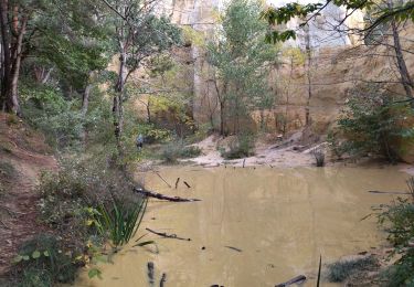
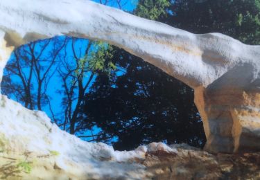
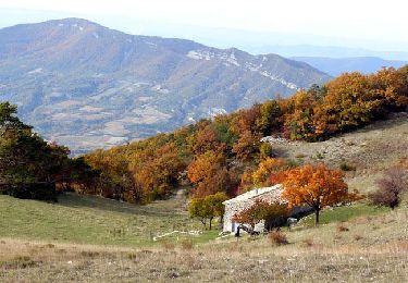
de beaux paysages mais beaucoup de portions goudronnées. Une partie du chemin vers le point de vue n'existe pas. Nous avons aussi dû franchir 2 clotures sur le chemin vers la Motte.


Trails nearby

Trail Walking Montjoux - Le Devès - Montjoux - Photo
Walking
tracegps

Walking

Easy
(1)
Montjoux, Auvergne-Rhône-Alpes, Drôme, France
5.3 km | 7 km-effort
1h 19min
Yes
Trail Walking Dieulefit - 26 dieulefit chap st Maurice vitrouilleres - Photo
Walking
himba26100

Walking

Easy
Dieulefit, Auvergne-Rhône-Alpes, Drôme, France
13.8 km | 23 km-effort
6h 17min
Yes
Trail Walking Dieulefit - Vitrouillières Dieulefit  - Photo
Walking
alinetpierre

Walking

Medium
Dieulefit, Auvergne-Rhône-Alpes, Drôme, France
14.8 km | 25 km-effort
4h 28min
Yes
Trail Walking Montjoux - 2022-12-16_08h52m12_tmpWriteApidae_48958_fr - Photo
Walking
chancha

Walking

Easy
Montjoux, Auvergne-Rhône-Alpes, Drôme, France
6.1 km | 8.4 km-effort
1h 55min
Yes
Trail Walking Dieulefit - 2022-09-03_11h50m30_Chapelle St Maurice 10km.gpx (3).xml - Photo
Walking
chancha

Walking

Difficult
Dieulefit, Auvergne-Rhône-Alpes, Drôme, France
10 km | 17.1 km-effort
3h 53min
Yes
Trail sport Vesc - Wikiloc - Vesc - Photo
sport
johnw

sport

Very easy
(1)
Vesc, Auvergne-Rhône-Alpes, Drôme, France
8 km | 12.9 km-effort
Unknown
Yes
Trail Walking Vesc - bec de jus - Photo
Walking
Vero7684

Walking

Difficult
Vesc, Auvergne-Rhône-Alpes, Drôme, France
13.6 km | 25 km-effort
5h 51min
Yes
Trail Walking Dieulefit - Chapelle St Maurice-Col Pertuis 11km - Photo
Walking
GUIDE
thonyc

Walking

Medium
Dieulefit, Auvergne-Rhône-Alpes, Drôme, France
11.4 km | 19.8 km-effort
4h 27min
Yes
Trail Walking Bourdeaux - col de Boutière 1 - Photo
Walking
AIGUIER

Walking

Medium
(1)
Bourdeaux, Auvergne-Rhône-Alpes, Drôme, France
13.3 km | 19 km-effort
5h 18min
Yes


Close
My subscriptions