Trail Walking Allanche - Allanche - Maillargues Puy de Mathonière - 12.8km 320m 4h00 - 2019 06 25 - Photo

Allanche - Maillargues Puy de Mathonière - 12.8km 320m 4h00 - 2019 06 25

 Orcal37
Orcal37

User

© OpenStreetMap contributors
Length
Length
12.8 km
Max alt
Max alt
1215 m
Uphill gradient
Uphill gradient
319 m
Km-Effort
Km-Effort  
17 km
Min alt
Min alt
971 m
Downhill gradient
Downhill gradient
318 m
Boucle
Boucle
Yes
Creation date :
2019-06-25 11:29:36.869
Updated on :
2021-09-08 13:23:59.096

(0 Reviews)

Walking
Walking
4h00
Difficulty : Easy

Scan this QR Code to open this trail in the SityTrail application

FREE GPS app for hiking

Logo SityTrail SityTrail

IGN / Geographical institutes

Download SityTrail from the App Store Download SityTrail from Google Play

Logo SityTrail SityTrail World

The world is yours!

Download SityTrail from the App Store Download SityTrail from Google Play Download SityTrail on Huawei AppGallery

About

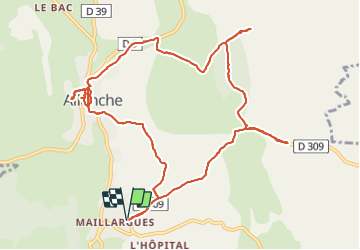
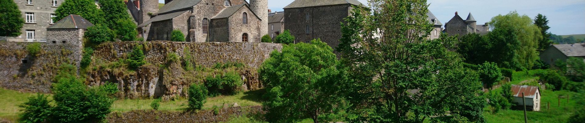
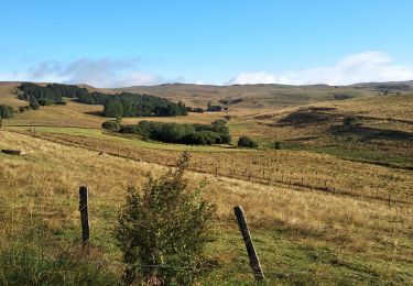
Trail Walking of 12.8 km to be discovered at Auvergne-Rhône-Alpes, Cantal, Allanche. This trail is proposed by Orcal37.

Description

Allanche - de Maillargues au Puy de Mathonière - 12.8km 320m 4h00 - 2019 06 25

Elevation profile

Photos

Positioning

Country:
France
Region :
Auvergne-Rhône-Alpes
Department/Province :
Cantal
Municipality :
Allanche
Location:
Unknown
Start:(UTM)
495385 ; 5006744 (31T) N.

Trails nearby

Trail Walking Allanche - Allanche-marcenat - TVR - jour 1 - Photo
Walking
alinetpierre

Walking

Medium
Allanche, Auvergne-Rhône-Alpes, Cantal, France
24 km | 31 km-effort
6h 39min
No
Trail Walking Allanche - circuits du cezera - Photo
Walking
martial15

Walking

Medium
Allanche, Auvergne-Rhône-Alpes, Cantal, France
14.5 km | 18.8 km-effort
4h 17min
Yes
Trail Walking Neussargues en Pinatelle - lac du pêcher - Photo
Walking
micksop

Walking

Neussargues en Pinatelle, Auvergne-Rhône-Alpes, Cantal, France
11.7 km | 14.4 km-effort
2h 58min
Yes
Trail Road bike Allanche - le Cezallier - Photo
Road bike
Jean-Marie Bousquet

Road bike

Medium
Allanche, Auvergne-Rhône-Alpes, Cantal, France
74 km | 90 km-effort
3h 34min
No
Trail Mountain bike Allanche - Saint Flour - Photo
Mountain bike
lorenzot54

Mountain bike

Allanche, Auvergne-Rhône-Alpes, Cantal, France
48 km | 0 m-effort
6h 23min
No
Trail Walking Allanche - 20230904 Allanches murat - Photo
Walking
marieamelie

Walking

Very difficult
Allanche, Auvergne-Rhône-Alpes, Cantal, France
26 km | 36 km-effort
9h 41min
No
Trail Mountain bike Neussargues en Pinatelle - vallée de cezera - Photo
Mountain bike
arnaudjl

Mountain bike

Very easy
Neussargues en Pinatelle, Auvergne-Rhône-Alpes, Cantal, France
24 km | 32 km-effort
2h 37min
No
Trail Equestrian Neussargues en Pinatelle - TDV-Lac du Pecher-Le Claux - Photo
Equestrian
Sophie Roscheck

Equestrian

Very easy
Neussargues en Pinatelle, Auvergne-Rhône-Alpes, Cantal, France
21 km | 29 km-effort
Unknown
No
Trail Walking Neussargues en Pinatelle - lac du PECHER  - lac sauvage - Photo
Walking
gerard42

Walking

Easy
(2)
Neussargues en Pinatelle, Auvergne-Rhône-Alpes, Cantal, France
12.7 km | 16.2 km-effort
3h 38min
Yes


Close
My subscriptions