Trail Car Molines-en-Queyras - Tour des escartons - Photo
 yjguerin
yjguerin

User

© OpenStreetMap contributors
Length
Length
277 km
Max alt
Max alt
2743 m
Uphill gradient
Uphill gradient
9171 m
Km-Effort
Km-Effort  
399 km
Min alt
Min alt
305 m
Downhill gradient
Downhill gradient
9176 m
Boucle
Boucle
Yes
Creation date :
2019-07-02 08:06:24.0
Updated on :
2019-07-03 19:45:13.322

(0 Reviews)

Car
Car
9h00
Difficulty : Easy

Scan this QR Code to open this trail in the SityTrail application

FREE GPS app for hiking

Logo SityTrail SityTrail

IGN / Geographical institutes

Download SityTrail from the App Store Download SityTrail from Google Play

Logo SityTrail SityTrail World

The world is yours!

Download SityTrail from the App Store Download SityTrail from Google Play Download SityTrail on Huawei AppGallery

About

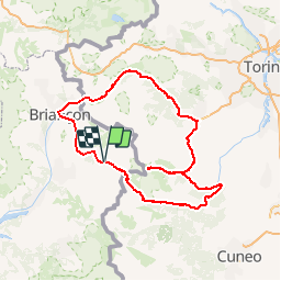
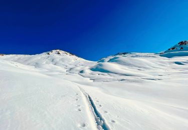
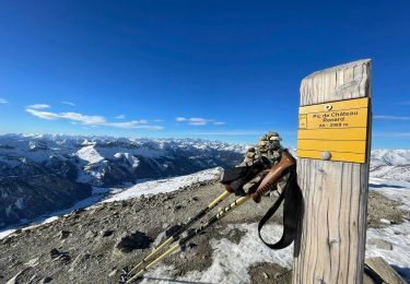
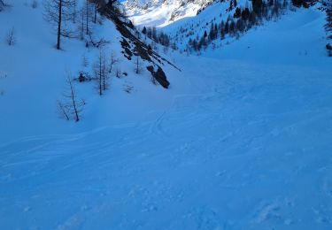
Trail Car of 277 km to be discovered at Provence-Alpes-Côte d'Azur, Hautes-Alpes, Molines-en-Queyras. This trail is proposed by yjguerin.

Description

De Molines à la Val Varaita,
Repas à Crissolo et balade pédestre à Pian del Ré (sources du Pô)
Retour par Sestrière, Montgenèvre et le col d'Izoard

Elevation profile

Positioning

Country:
France
Region :
Provence-Alpes-Côte d'Azur
Department/Province :
Hautes-Alpes
Municipality :
Molines-en-Queyras
Location:
Unknown
Start:(UTM)
331608 ; 4954798 (32T) N.

Trails nearby

Trail Walking Château-Ville-Vieille - Queyras j1 - Photo
Walking
Ninie38MD

Walking

Medium
(1)
Château-Ville-Vieille, Provence-Alpes-Côte d'Azur, Hautes-Alpes, France
19.1 km | 36 km-effort
8h 6min
No
Trail Walking Saint-Véran - Pic de Château Renard 2989 m - Photo
Walking
astro45

Walking

Medium
(1)
Saint-Véran, Provence-Alpes-Côte d'Azur, Hautes-Alpes, France
6.9 km | 16.1 km-effort
2h 43min
No
Trail Walking Saint-Véran - boucle St Veran - Refuge de la blanche - Photo
Walking
gildascb

Walking

Medium
(1)
Saint-Véran, Provence-Alpes-Côte d'Azur, Hautes-Alpes, France
19.3 km | 28 km-effort
5h 15min
Yes
Trail Walking Château-Ville-Vieille - Ville-vieille - Ceillac - Photo
Walking
GUIDE
romanceline

Walking

Medium
Château-Ville-Vieille, Provence-Alpes-Côte d'Azur, Hautes-Alpes, France
17.4 km | 31 km-effort
6h 51min
No
Trail Other activity Molines-en-Queyras - ski tour du Rouchon - Photo
Other activity
CYCLOHC

Other activity

Medium
(2)
Molines-en-Queyras, Provence-Alpes-Côte d'Azur, Hautes-Alpes, France
8.6 km | 20 km-effort
5h 24min
No
Trail Walking Saint-Véran - saint véranda les hameaux le champ et le raux - Photo
Walking
marchev

Walking

Easy
Saint-Véran, Provence-Alpes-Côte d'Azur, Hautes-Alpes, France
4.9 km | 7.9 km-effort
1h 44min
No
Trail Snowshoes Saint-Véran - Saint Véran - Col de Chamoussière - Pic de Caramantran - Refuge de la Blanche - Photo
Snowshoes
Pierre Lefèvre

Snowshoes

Difficult
Saint-Véran, Provence-Alpes-Côte d'Azur, Hautes-Alpes, France
22 km | 38 km-effort
5h 30min
Yes
Trail Snowshoes Molines-en-Queyras - Pont de Lariane - Col de Longet - Observatoire et Pic de Château Renard - Photo
Snowshoes
Pierre Lefèvre

Snowshoes

Medium
Molines-en-Queyras, Provence-Alpes-Côte d'Azur, Hautes-Alpes, France
16.1 km | 30 km-effort
5h 0min
Yes
Trail Touring skiing Saint-Véran - tête de la Cula - Photo
Touring skiing
tchoua

Touring skiing

Difficult
Saint-Véran, Provence-Alpes-Côte d'Azur, Hautes-Alpes, France
14.2 km | 31 km-effort
3h 31min
Yes


Close
My subscriptions