


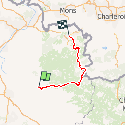
Avesnois - Thierache

plevier
User

Length
100 km

Max alt
266 m

Uphill gradient
1030 m
Km-Effort
113 km

Min alt
101 m

Downhill gradient
997 m
Boucle
No
Creation date :
2019-07-16 12:12:55.257
Updated on :
2019-07-19 10:27:07.404
--
Difficulty : Very easy

FREE GPS app for hiking
 SityTrail
IGN / Geographical institutes
SityTrail Plus
The world is yours!
About
Trail Cycle of 100 km to be discovered at Hauts-de-France, Aisne, Guise. This trail is proposed by plevier.
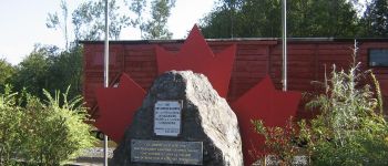
Photos


Points of interest


Positioning
Country:
France
Region :
Hauts-de-France
Department/Province :
Aisne
Municipality :
Guise
Location:
Unknown
Start:(Dec)
Start:(UTM)
544858 ; 5527545 (31U) N.
Comments