Trail Running Arles-sur-Tech - 100 Miles Sud de France 2019 - La Traversée - Photo

100 Miles Sud de France 2019 - La Traversée

 toficou
toficou

User

© OpenStreetMap contributors
Length
Length
76 km
Max alt
Max alt
1435 m
Uphill gradient
Uphill gradient
3610 m
Km-Effort
Km-Effort  
125 km
Min alt
Min alt
-1 m
Downhill gradient
Downhill gradient
3876 m
Boucle
Boucle
No
Creation date :
2019-07-22 16:41:05.396
Updated on :
2019-07-22 16:43:07.682

(0 Reviews)

Running
Running
--
Difficulty : Very easy

Scan this QR Code to open this trail in the SityTrail application

FREE GPS app for hiking

Logo SityTrail SityTrail

IGN / Geographical institutes

Download SityTrail from the App Store Download SityTrail from Google Play

Logo SityTrail SityTrail World

The world is yours!

Download SityTrail from the App Store Download SityTrail from Google Play Download SityTrail on Huawei AppGallery

About

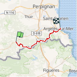
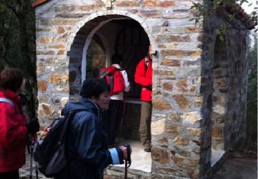
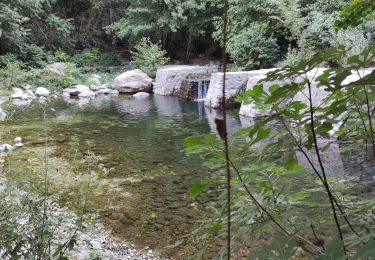
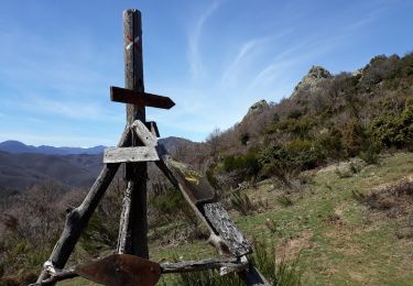
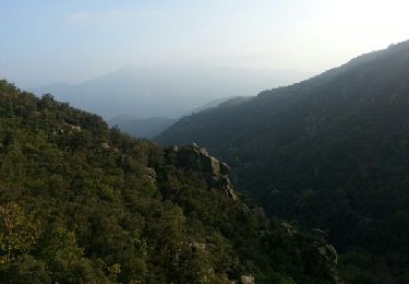
Trail Running of 76 km to be discovered at Occitania, Pyrénées-Orientales, Arles-sur-Tech. This trail is proposed by toficou.

Description

ARLES SUR TECH _ ARGELES

Elevation profile

Positioning

Country:
France
Region :
Occitania
Department/Province :
Pyrénées-Orientales
Municipality :
Arles-sur-Tech
Location:
Unknown
Start:(Dec)
Start:(UTM)
470595 ; 4700985 (31T) N.

Trails nearby

Trail Walking Montbolo - Montbolo: du col dela reducta au col de Formentera - Photo
Walking
robertperello

Walking

Medium
Montbolo, Occitania, Pyrénées-Orientales, France
11.9 km | 17 km-effort
3h 4min
Yes
Trail Walking Amélie-les-Bains-Palalda - Montalba roc St Sauveur  - Photo
Walking
francineposkin

Walking

Difficult
Amélie-les-Bains-Palalda, Occitania, Pyrénées-Orientales, France
7.8 km | 13.3 km-effort
4h 0min
No
Trail Walking Amélie-les-Bains-Palalda - A/R Roc St sauveur  - Photo
Walking
Mamilaure

Walking

Medium
Amélie-les-Bains-Palalda, Occitania, Pyrénées-Orientales, France
6.4 km | 14.4 km-effort
2h 46min
Yes
Trail Walking Amélie-les-Bains-Palalda - Amélie les Bains - Roc de la Campana - Photo
Walking
MarieFrancoise

Walking

Very difficult
Amélie-les-Bains-Palalda, Occitania, Pyrénées-Orientales, France
13.5 km | 22 km-effort
6h 16min
Yes
Trail Walking Arles-sur-Tech - D'Arles sur Tech à Saint Laurent de Cerdans - Photo
Walking
tracegps

Walking

Difficult
Arles-sur-Tech, Occitania, Pyrénées-Orientales, France
18.5 km | 30 km-effort
6h 0min
No
Trail Walking Montferrer - Château de Montferrer - Photo
Walking
perittel

Walking

Easy
(2)
Montferrer, Occitania, Pyrénées-Orientales, France
9.8 km | 14.2 km-effort
3h 32min
Yes
Trail Walking Amélie-les-Bains-Palalda - AMELIE STA ENGRACIA - Photo
Walking
MarcOBRECHT

Walking

Medium
Amélie-les-Bains-Palalda, Occitania, Pyrénées-Orientales, France
9.9 km | 18.6 km-effort
3h 44min
Yes
Trail Walking Amélie-les-Bains-Palalda - Montalba - Roc Saint Sauveur - Photo
Walking
patbt

Walking

Medium
Amélie-les-Bains-Palalda, Occitania, Pyrénées-Orientales, France
12.5 km | 22 km-effort
6h 5min
Yes
Trail Walking Montbolo - Val de Bonabosc_T - Photo
Walking
force

Walking

Very easy
Montbolo, Occitania, Pyrénées-Orientales, France
10.2 km | 16.1 km-effort
3h 53min
Yes


Close
My subscriptions