


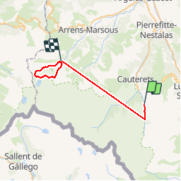

11.4 km | 17.5 km-effort


User


FREE GPS app for hiking
 SityTrail
IGN / Geographical institutes
SityTrail World
The world is yours!
Trail Walking of 37 km to be discovered at Occitania, Hautespyrenees, Cauterets. This trail is proposed by pffrench.


Walking

Walking

Walking

Walking

Walking

Walking

Walking
Walking

Walking
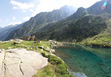
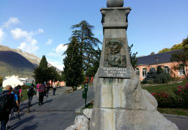
Enregistrement débile du trajet. seules les photos ont un intérêt.