


srp3 pap

abricot2
User
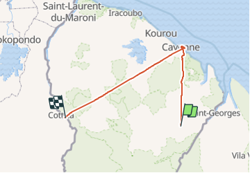

Length
410 km

Max alt
277 m

Uphill gradient
14499 m
Km-Effort
603 km

Min alt
-1 m

Downhill gradient
14546 m
Boucle
No
Creation date :
2019-07-22 15:30:02.546
Updated on :
2019-07-23 18:52:43.585
22h06
Difficulty : Very easy

FREE GPS app for hiking
 SityTrail
IGN / Geographical institutes
SityTrail World
The world is yours!
About
Trail Walking of 410 km to be discovered at French Guiana, Unknown, Saint-Georges. This trail is proposed by abricot2.
Description
fgggg
Positioning
Country:
France
Region :
French Guiana
Department/Province :
Unknown
Municipality :
Saint-Georges
Location:
Unknown
Start:(Dec)
Start:(UTM)
352650 ; 406447 (22N) N.
Comments
Trails nearby