


60 le rognon

guy07
User
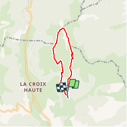

Length
9.2 km

Max alt
1800 m

Uphill gradient
562 m
Km-Effort
16.8 km

Min alt
1241 m

Downhill gradient
577 m
Boucle
No
Creation date :
2019-07-08 06:07:45.955
Updated on :
2019-07-25 08:02:21.247
4h03
Difficulty : Very easy

FREE GPS app for hiking
 SityTrail
IGN / Geographical institutes
SityTrail Plus
The world is yours!
About
Trail Walking of 9.2 km to be discovered at Auvergne-Rhône-Alpes, Drôme, Lus-la-Croix-Haute. This trail is proposed by guy07.
Positioning
Country:
France
Region :
Auvergne-Rhône-Alpes
Department/Province :
Drôme
Municipality :
Lus-la-Croix-Haute
Location:
Unknown
Start:(Dec)
Start:(UTM)
714417 ; 4952808 (31T) N.
Comments