Trail Walking Sturzelbronn - De Turzelbronn à Bremendell - Photo

De Turzelbronn à Bremendell

 tracegps
tracegps

User

© OpenStreetMap contributors
Length
Length
14.6 km
Max alt
Max alt
385 m
Uphill gradient
Uphill gradient
426 m
Km-Effort
Km-Effort  
20 km
Min alt
Min alt
245 m
Downhill gradient
Downhill gradient
426 m
Boucle
Boucle
Yes
Creation date :
2014-12-10 00:00:00.0
Updated on :
2014-12-10 00:00:00.0

(0 Reviews)

Walking
Walking
3h30
Difficulty : Medium

Scan this QR Code to open this trail in the SityTrail application

FREE GPS app for hiking

Logo SityTrail SityTrail

IGN / Geographical institutes

Download SityTrail from the App Store Download SityTrail from Google Play

Logo SityTrail SityTrail World

The world is yours!

Download SityTrail from the App Store Download SityTrail from Google Play Download SityTrail on Huawei AppGallery

About

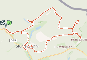
Trail Walking of 14.6 km to be discovered at Grand Est, Moselle, Sturzelbronn. This trail is proposed by tracegps.

Description

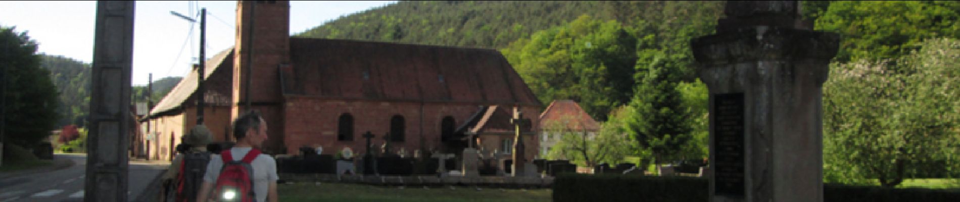
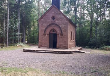
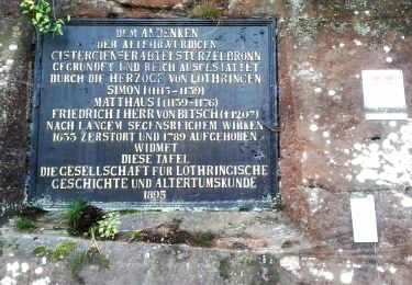
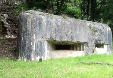
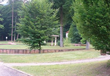
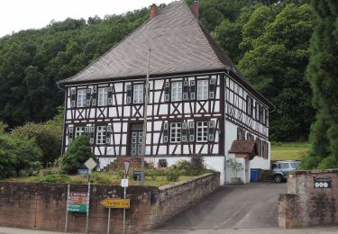
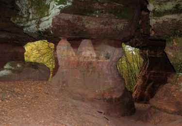
Départdu parking d'Erlenmoos à côté du petit étang en bordure de la D35. Emprunter le chemin balisé croix jaune jusqu’au carrefour de chemins à Muehlenbach. Continuer sur balisage anneau vert jusqu’au rocher du Luchsfelsen. A partir du hameau de Bremendell, suivre le balisage anneau rouge vers carrefour du Kreuzberg, stèle (5 morts lors d’une embuscade le 9 juin 1940), monter jusqu’à la grande croix qui domine Sturzelbronn, descendre par le sentier en lacets. Arrivé en bas, continuer sur anneau rouge, à gauche, vers le village et l’église. Puis disque rouge jusqu’au carrefour du Grand Eichenberg. Suite sur croix jaune pour le retour vers le parking Erlenmoos. D'autres infos dans le topoguide du club vosgien de Bitche : "Balades dans le Pays de Bitche", circuit n°18.

Elevation profile

Photos

Positioning

Country:
France
Region :
Grand Est
Department/Province :
Moselle
Municipality :
Sturzelbronn
Location:
Unknown
Start:(Dec)
Start:(UTM)
395732 ; 5435664 (32U) N.

Trails nearby

Trail Walking Éguelshardt - Notre Dame des Bois - Photo
Walking
oscar1

Walking

Medium
(1)
Éguelshardt, Grand Est, Moselle, France
17.3 km | 24 km-effort
4h 4min
Yes
Trail Walking Roppeviller - Le rocher de l'Altschlossfelsen - Photo
Walking
VacheKiri67

Walking

Easy
(1)
Roppeviller, Grand Est, Moselle, France
13 km | 16.1 km-effort
3h 30min
Yes
Trail On foot Sturzelbronn - Autour des moines de Sturzelbronn - Photo
On foot
PRO

On foot

Easy
Sturzelbronn, Grand Est, Moselle, France
10.9 km | 14.8 km-effort
3h 22min
Yes
Trail On foot Sturzelbronn - Scenic cross-border trail No. 3 - Photo
On foot
PRO

On foot

Easy
Sturzelbronn, Grand Est, Moselle, France
10 km | 13.8 km-effort
3h 8min
Yes
Trail On foot Philippsbourg - Blue dot - Photo
On foot
PRO

On foot

Easy
Philippsbourg, Grand Est, Moselle, France
6.6 km | 8.3 km-effort
1h 53min
No
Trail On foot Sturzelbronn - Blue cross - Photo
On foot
PRO

On foot

Difficult
Sturzelbronn, Grand Est, Moselle, France
27 km | 37 km-effort
8h 29min
No
Trail On foot Roppeviller - Circuit du rocher de l'Altschlossfelsen - Photo
On foot
PRO

On foot

Easy
Roppeviller, Grand Est, Moselle, France
7.1 km | 9.7 km-effort
2h 12min
Yes
Trail On foot Eppenbrunn - Rundwanderweg Eppenbrunn 4 - Photo
On foot
PRO

On foot

Easy
Eppenbrunn, Rhineland-Palatinate, Südwestpfalz, Germany
7 km | 9.3 km-effort
2h 7min
Yes
Trail On foot Eppenbrunn - Rundwanderweg Eppenbrunn 3 - Photo
On foot
PRO

On foot

Easy
Eppenbrunn, Rhineland-Palatinate, Südwestpfalz, Germany
4.2 km | 5.8 km-effort
1h 18min
No


Close
My subscriptions