De Beaugency à Chambord
tracegps
User
Length
28 km
Max alt
109 m
Uphill gradient
224 m
Km-Effort
31 km
Min alt
70 m
Downhill gradient
197 m
Boucle
No
Creation date :
2014-12-10 00:00:00.0
Updated on :
2014-12-10 00:00:00.0
1h49
Difficulty : Easy
FREE GPS app for hiking
About
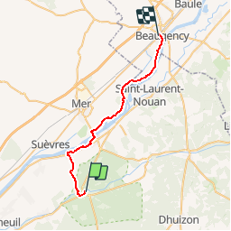
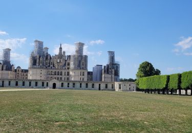
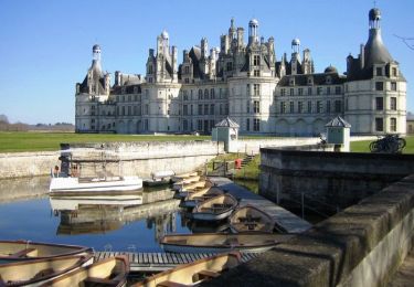
Trail Cycle of 28 km to be discovered at Centre-Loire Valley, Loir-et-Cher, Chambord. This trail is proposed by tracegps.
Description
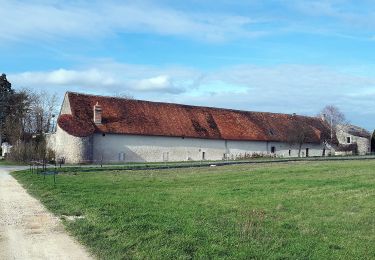
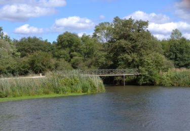
Une jolie balade familiale où se mêlent Loire Sauvage et villages pittoresques. Puis c'est la Sologne et son massif forestier qui nous enveloppe. Un parcours apaisant effectué en majorité sur pistes cyclables. A faire absolument!
Positioning
Country:
France
Region :
Centre-Loire Valley
Department/Province :
Loir-et-Cher
Municipality :
Chambord
Location:
Unknown
Start:(Dec)
Start:(UTM)
388383 ; 5274866 (31T) N.
Comments
Trails nearby
Château de Saumery
On foot
Easy
Huisseau-sur-Cosson,
Centre-Loire Valley,
Loir-et-Cher,
France
8.2 km | 8.9 km-effort
2h 1min
Yes
La Plaine des Landes
On foot
Easy
Huisseau-sur-Cosson,
Centre-Loire Valley,
Loir-et-Cher,
France
6.9 km | 7.5 km-effort
1h 41min
Yes
petite marche 6 km dans chambord
On foot
Easy
(1)
Chambord,
Centre-Loire Valley,
Loir-et-Cher,
France
6.1 km | 6.9 km-effort
1h 33min
Yes
chambord-cheverny
Mountain bike
Easy
(1)
Chambord,
Centre-Loire Valley,
Loir-et-Cher,
France
23 km | 25 km-effort
1h 41min
No
Domaine de Chambord
Walking
Easy
(1)
Huisseau-sur-Cosson,
Centre-Loire Valley,
Loir-et-Cher,
France
59 km | 65 km-effort
4h 39min
No
chambord
Walking
Easy
Chambord,
Centre-Loire Valley,
Loir-et-Cher,
France
3.8 km | 4.4 km-effort
4h 7min
Yes
Chambord-Rond point François 1°
Walking
Very easy
Chambord,
Centre-Loire Valley,
Loir-et-Cher,
France
8.7 km | 9.7 km-effort
1h 55min
Yes
De Chambord à Beaugency
Cycle
Medium
Chambord,
Centre-Loire Valley,
Loir-et-Cher,
France
66 km | 71 km-effort
3h 15min
Yes
malives
Walking
Very easy
Maslives,
Centre-Loire Valley,
Loir-et-Cher,
France
12.7 km | 13.7 km-effort
2h 59min
Yes