


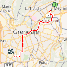

10.9 km | 26 km-effort


User

FREE GPS app for hiking
 SityTrail
IGN / Geographical institutes
SityTrail World
The world is yours!
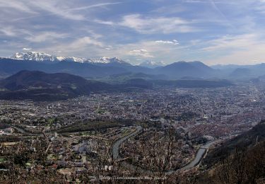
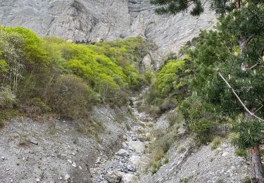
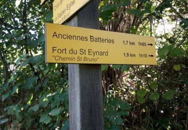
Trail Hybrid bike of 9 km to be discovered at Auvergne-Rhône-Alpes, Isère, Meylan. This trail is proposed by Domie38.
Retour travail domicile via poste et Auchan Avec vent de face et coup de tel en roulant sur berges
Walking

Mountain bike
On foot

On foot

Mountain bike
Walking
Walking
Walking
Walking