Trail Mountain bike Seyssins - Rocher du Chatelard - Photo
© OpenStreetMap contributors
Length
Length
27 km
Max alt
Max alt
1243 m
Uphill gradient
Uphill gradient
1221 m
Km-Effort
Km-Effort  
43 km
Min alt
Min alt
222 m
Downhill gradient
Downhill gradient
1221 m
Boucle
Boucle
Yes
Creation date :
2019-07-31 18:21:23.702
Updated on :
2019-08-01 09:26:03.142

(0 Reviews)

Mountain bike
Mountain bike
3h45
Difficulty : Difficult

Scan this QR Code to open this trail in the SityTrail application

FREE GPS app for hiking

Logo SityTrail SityTrail

IGN / Geographical institutes

Download SityTrail from the App Store Download SityTrail from Google Play

Logo SityTrail SityTrail World

The world is yours!

Download SityTrail from the App Store Download SityTrail from Google Play Download SityTrail on Huawei AppGallery

About

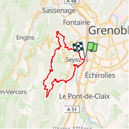
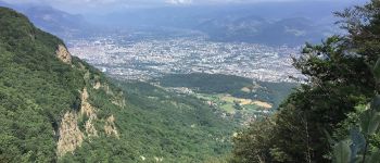
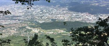
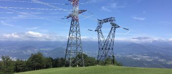
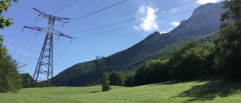
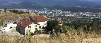
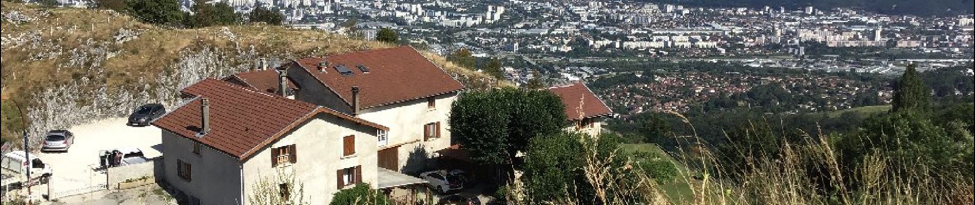
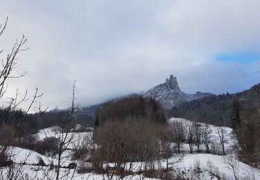
Trail Mountain bike of 27 km to be discovered at Auvergne-Rhône-Alpes, Isère, Seyssins. This trail is proposed by cazycricri.

Elevation profile

Photos

Points of interest

Point of interest Claix - Agglo Grenoble - Photo
cazycricri
Point of interest Seyssinet-Pariset - Fée électricité - Photo
cazycricri
SEYSSINET-PARISET 
Point of interest Seyssinet-Pariset - Chateau Bouvier, Moucherotte - Photo
cazycricri
SEYSSINET-PARISET 
Point of interest Seyssinet-Pariset - Abords Tour sans Venin - Photo
cazycricri
SEYSSINET-PARISET 

Positioning

Country:
France
Region :
Auvergne-Rhône-Alpes
Department/Province :
Isère
Municipality :
Seyssins
Location:
Unknown
Start:(UTM)
712122 ; 5004291 (31T) N.

Trails nearby

Trail Nordic walking Seyssins - Seyssins le haut - Les Arcelles dans la neige - Photo
Nordic walking
patjobou

Nordic walking

Medium
(1)
Seyssins, Auvergne-Rhône-Alpes, Isère, France
9.1 km | 13.8 km-effort
2h 45min
Yes
Trail Walking Seyssins - MOUCHEROTTE - Photo
Walking
Ninie38MD

Walking

Difficult
(1)
Seyssins, Auvergne-Rhône-Alpes, Isère, France
20 km | 40 km-effort
8h 9min
Yes
Trail Mountain bike Seyssins - Petite escapade électrique au-dessus de 38 Seyssins - Photo
Mountain bike
patjobou

Mountain bike

Easy
(1)
Seyssins, Auvergne-Rhône-Alpes, Isère, France
12.3 km | 19.7 km-effort
1h 29min
Yes
Trail Walking Fontaine - M le 20 cabane de Laura - Photo
Walking
Ninie38MD

Walking

Difficult
(1)
Fontaine, Auvergne-Rhône-Alpes, Isère, France
16.8 km | 30 km-effort
6h 59min
Yes
Trail Running Seyssinet-Pariset - 19 mai - Photo
Running
Quirole

Running

Very easy
(1)
Seyssinet-Pariset, Auvergne-Rhône-Alpes, Isère, France
5.7 km | 6.5 km-effort
1h 11min
Yes
Trail Mountain bike Grenoble - Grande Traversée des PréAlpes à VTT : Grenoble - Sisteron - Digne les Bains - Photo
Mountain bike
tracegps

Mountain bike

Very difficult
(2)
Grenoble, Auvergne-Rhône-Alpes, Isère, France
375 km | 539 km-effort
48h 0min
No
Trail On foot La Tronche - Grande Traverse de Meylan - Photo
On foot
PRO

On foot

Easy
La Tronche, Auvergne-Rhône-Alpes, Isère, France
5.6 km | 6.5 km-effort
1h 28min
No
Trail Nordic walking Claix - Le Peuil 5 Km - Photo
Nordic walking
patjobou

Nordic walking

Easy
(1)
Claix, Auvergne-Rhône-Alpes, Isère, France
5.3 km | 7.1 km-effort
1h 28min
Yes
Trail Mountain bike La Tronche - bastille vtt - Photo
Mountain bike
virtumanu

Mountain bike

Medium
(1)
La Tronche, Auvergne-Rhône-Alpes, Isère, France
11.1 km | 19.6 km-effort
24min
Yes


Close
My subscriptions