


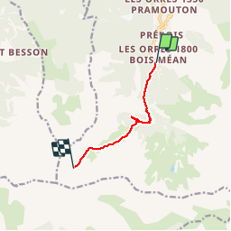

7.7 km | 13.7 km-effort


User


FREE GPS app for hiking
 SityTrail
IGN / Geographical institutes
SityTrail World
The world is yours!
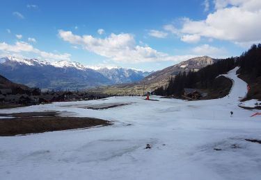
Trail Walking of 6.1 km to be discovered at Provence-Alpes-Côte d'Azur, Hautes-Alpes, Les Orres. This trail is proposed by qlqin.
Sportif à partir de 8 ans, superbes petites vallées d'altitude avant d'atteindre (avec beaucoup de discrétion)le fond du vallon et ses marmottes. le trajet est 1 aller-retour (pas de boucle).
Walking

Walking

Walking

Mountain bike
Walking
Walking

Touring skiing

Snowshoes
Touring skiing