Trail Walking Obersteinbach - rando Vosges du Nord chateau en chateau - Photo

rando Vosges du Nord chateau en chateau

© OpenStreetMap contributors
Length
Length
57 km
Max alt
Max alt
553 m
Uphill gradient
Uphill gradient
2116 m
Km-Effort
Km-Effort  
85 km
Min alt
Min alt
206 m
Downhill gradient
Downhill gradient
2116 m
Boucle
Boucle
Yes
Creation date :
2019-08-15 11:46:13.196
Updated on :
2019-09-16 12:31:14.946

(0 Reviews)

Walking
Walking
18h28
Difficulty : Very easy

Scan this QR Code to open this trail in the SityTrail application

FREE GPS app for hiking

Logo SityTrail SityTrail

IGN / Geographical institutes

Download SityTrail from the App Store Download SityTrail from Google Play

Logo SityTrail SityTrail World

The world is yours!

Download SityTrail from the App Store Download SityTrail from Google Play Download SityTrail on Huawei AppGallery

About

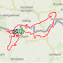
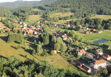
Trail Walking of 57 km to be discovered at Grand Est, Bas-Rhin, Obersteinbach. This trail is proposed by micheldutilleul.

Description

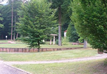
Attention, une courte partie du tracé était à travers bois. Le chemin figurant sur la carte n'existait plus.

Elevation profile

Positioning

Country:
France
Region :
Grand Est
Department/Province :
Bas-Rhin
Municipality :
Obersteinbach
Location:
Unknown
Start:(UTM)
404057 ; 5432281 (32U) N.

Trails nearby

Trail On foot Lembach - Anneau bleu - Photo
On foot
PRO

On foot

Easy
Lembach, Grand Est, Bas-Rhin, France
3.7 km | 5.4 km-effort
1h 14min
Yes
Trail On foot Niedersteinbach - Losange jaune - Photo
On foot
PRO

On foot

Easy
Niedersteinbach, Grand Est, Bas-Rhin, France
3.5 km | 5.1 km-effort
1h 9min
No
Trail On foot Niedersteinbach - Anneau bleu - Photo
On foot
PRO

On foot

Easy
Niedersteinbach, Grand Est, Bas-Rhin, France
3.9 km | 6.8 km-effort
1h 32min
Yes
Trail On foot Niedersteinbach - Anneau jaune - Photo
On foot
PRO

On foot

Easy
Niedersteinbach, Grand Est, Bas-Rhin, France
3.4 km | 4.9 km-effort
1h 6min
Yes
Trail On foot Obersteinbach - Anneau jaune - Photo
On foot
PRO

On foot

Easy
Obersteinbach, Grand Est, Bas-Rhin, France
3.8 km | 6.2 km-effort
1h 25min
Yes
Trail On foot Obersteinbach - Triangle rouge - Photo
On foot
PRO

On foot

Medium
Obersteinbach, Grand Est, Bas-Rhin, France
14.1 km | 21 km-effort
4h 45min
No
Trail On foot Schönau (Pfalz) - Triangle rouge - Photo
On foot
PRO

On foot

Easy
Schönau (Pfalz), Rhineland-Palatinate, Südwestpfalz, Germany
5.5 km | 8.2 km-effort
1h 51min
No
Trail On foot Niedersteinbach - Croix rouge - Photo
On foot
PRO

On foot

Easy
Niedersteinbach, Grand Est, Bas-Rhin, France
5.7 km | 9.5 km-effort
2h 9min
No
Trail On foot Obersteinbach - Anneau rouge - Photo
On foot
PRO

On foot

Easy
Obersteinbach, Grand Est, Bas-Rhin, France
3.8 km | 4.9 km-effort
1h 7min
Yes


Close
My subscriptions