Trail Walking Area A (Kicking Horse/Kinbasket Lake) - Emerald Basin depuis Emerald Lake  - Photo
 GOHIER
GOHIER

User

© OpenStreetMap contributors
Length
Length
12.2 km
Max alt
Max alt
1553 m
Uphill gradient
Uphill gradient
320 m
Km-Effort
Km-Effort  
16.4 km
Min alt
Min alt
1291 m
Downhill gradient
Downhill gradient
319 m
Boucle
Boucle
Yes
Creation date :
2019-08-17 18:33:36.0
Updated on :
2019-08-19 14:36:31.379

(0 Reviews)

Walking
Walking
5h23
Difficulty : Unknown

Scan this QR Code to open this trail in the SityTrail application

FREE GPS app for hiking

Logo SityTrail SityTrail

IGN / Geographical institutes

Download SityTrail from the App Store Download SityTrail from Google Play

Logo SityTrail SityTrail World

The world is yours!

Download SityTrail from the App Store Download SityTrail from Google Play Download SityTrail on Huawei AppGallery

About

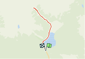
Trail Walking of 12.2 km to be discovered at British Columbia, Columbia-Shuswap Regional District, Area A (Kicking Horse/Kinbasket Lake). This trail is proposed by GOHIER.

Description

Looonng en forêt puis amphithéâtre de cascades et glacier. Beau!

Elevation profile

Positioning

Country:
Canada
Region :
British Columbia
Department/Province :
Columbia-Shuswap Regional District
Municipality :
Area A (Kicking Horse/Kinbasket Lake)
Location:
Unknown
Start:(UTM)
532078 ; 5698166 (11U) N.

Trails nearby

Trail Walking Area A (Kicking Horse/Kinbasket Lake) - Wikiloc - Emerald lake and Yoho pass - Photo
Walking
GUIDE
Alizée.pee

Walking

Difficult
Area A (Kicking Horse/Kinbasket Lake), British Columbia, Columbia-Shuswap Regional District, Canada
11.3 km | 15.1 km-effort
3h 12min
Yes


Close
My subscriptions