Trail Walking Brno - Rostislav kolacny  - Photo
© OpenStreetMap contributors
Length
Length
17.2 km
Max alt
Max alt
264 m
Uphill gradient
Uphill gradient
175 m
Km-Effort
Km-Effort  
19.6 km
Min alt
Min alt
199 m
Downhill gradient
Downhill gradient
178 m
Boucle
Boucle
No
Creation date :
2019-09-06 15:33:01.018
Updated on :
2019-09-06 21:39:05.749

(1 Reviews)

Walking
Walking
4h14
Difficulty : Very easy

Scan this QR Code to open this trail in the SityTrail application

FREE GPS app for hiking

Logo SityTrail SityTrail

IGN / Geographical institutes

Download SityTrail from the App Store Download SityTrail from Google Play

Logo SityTrail SityTrail World

The world is yours!

Download SityTrail from the App Store Download SityTrail from Google Play Download SityTrail on Huawei AppGallery

About

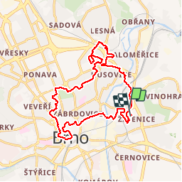
Trail Walking of 17.2 km to be discovered at Southeast, Jihomoravský kraj, Brno. This trail is proposed by Rostislav Kolacny.

Description

Brno Židenice Lužánky centrum

Elevation profile

Positioning

Country:
Czech Republic
Region :
Southeast
Department/Province :
Jihomoravský kraj
Municipality :
Brno
Location:
Unknown
Start:(UTM)
619454 ; 5451078 (33U) N.

Comments

Please log in to post a review or rate the element


Trails nearby

Trail Walking Brno - ke Svitav 1 - Photo
Walking
Rostislav Kolacny

Walking

Very easy
Brno, Southeast, Jihomoravský kraj, Czech Republic
14 km | 16.1 km-effort
3h 27min
Yes
Trail Walking Brno - lisen - Photo
Walking
Tomas Etasek

Walking

Easy
Brno, Southeast, Jihomoravský kraj, Czech Republic
73 m | 73 m-effort
1h 3min
No


Close
My subscriptions