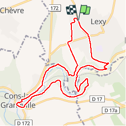
7.4 km | 9.6 km-effort
Lexy Cons Lexy 12-09-19
patdecosnes
User
Length
10.3 km
Max alt
357 m
Uphill gradient
231 m
Km-Effort
13.4 km
Min alt
236 m
Downhill gradient
231 m
Boucle
Yes
Creation date :
2019-09-12 12:00:04.559
Updated on :
2019-09-12 16:09:45.643
2h42
Difficulty : Easy
FREE GPS app for hiking
About
Trail Walking of 10.3 km to be discovered at Grand Est, Meurthe-et-Moselle, Lexy. This trail is proposed by patdecosnes.
Description
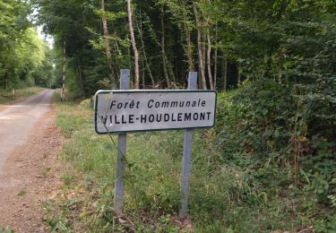
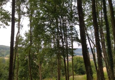
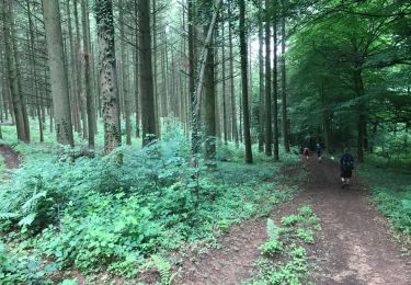
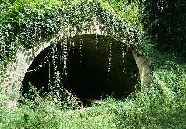
descente par le silot puis école de Cons et retour par le GR puis la station d'épuration et montée par chez Colle
Positioning
Country:
France
Region :
Grand Est
Department/Province :
Meurthe-et-Moselle
Municipality :
Lexy
Location:
Unknown
Start:(Dec)
Start:(UTM)
697157 ; 5486955 (31U) N.
Comments
Trails nearby
Chemin des Minières
Walking
Medium
Saint-Pancré,
Grand Est,
Meurthe-et-Moselle,
France
8.1 km | 9.7 km-effort
2h 15min
Yes
Balade 2
Walking
Easy
Ville-Houdlémont,
Grand Est,
Meurthe-et-Moselle,
France
558 m | 728 m-effort
27min
No
Longwy 19 km
Walking
Easy
Longwy,
Grand Est,
Meurthe-et-Moselle,
France
19.3 km | 25 km-effort
5h 46min
No
Mexy
Walking
Medium
Mexy,
Grand Est,
Meurthe-et-Moselle,
France
12.3 km | 15.4 km-effort
2h 34min
Yes
la boucle des villages frontaliers
Walking
Medium
Cosnes-et-Romain,
Grand Est,
Meurthe-et-Moselle,
France
26 km | 32 km-effort
7h 4min
Yes
Balade
Walking
Medium
Longwy,
Grand Est,
Meurthe-et-Moselle,
France
6.9 km | 9.2 km-effort
1h 29min
Yes
GORCY 2023-10-30
Walking
Medium
Musson,
Wallonia,
Luxembourg,
Belgium
9.4 km | 11.2 km-effort
2h 17min
Yes
REHON 2023-10-12
Walking
Difficult
Réhon,
Grand Est,
Meurthe-et-Moselle,
France
12.5 km | 15.8 km-effort
2h 57min
Yes