Trail Road bike Ostwald - Sortie - mixte VTT- Velo route  - Photo

Sortie - mixte VTT- Velo route

 26051010
26051010

User

© OpenStreetMap contributors
Length
Length
74 km
Max alt
Max alt
765 m
Uphill gradient
Uphill gradient
1139 m
Km-Effort
Km-Effort  
89 km
Min alt
Min alt
136 m
Downhill gradient
Downhill gradient
1138 m
Boucle
Boucle
Yes
Creation date :
2019-09-21 09:16:48.0
Updated on :
2019-09-21 15:56:42.899

(0 Reviews)

Road bike
Road bike
4h00
Difficulty : Medium
Mountain bike
Mountain bike
4h50
Difficulty : Medium

Scan this QR Code to open this trail in the SityTrail application

FREE GPS app for hiking

Logo SityTrail SityTrail

IGN / Geographical institutes

Download SityTrail from the App Store Download SityTrail from Google Play

Logo SityTrail SityTrail World

The world is yours!

Download SityTrail from the App Store Download SityTrail from Google Play Download SityTrail on Huawei AppGallery

About

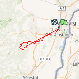
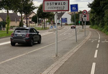
Trail Road bike of 74 km to be discovered at Grand Est, Bas-Rhin, Ostwald. This trail is proposed by 26051010.

Description

Sortie - mixte VTT- Velo route

Ostwald - Sainte-Odile
Départ Ostwald - Geispolsheim - Blaesheim-
Obernai- Ottrott- D 426 vorbruck
A maison forestière Vorbruck
Les VTT prennent à droite et les
Vélo route à gauche sur la DP 426
Au Sainte-Odile ont se retrouvent
Pour ST Jacques - direction Ottrott ST Nabor
Piste sur Rosheim- Innenheim - Blaesheim
Geispolsheim- Ostwald

Elevation profile

Photos

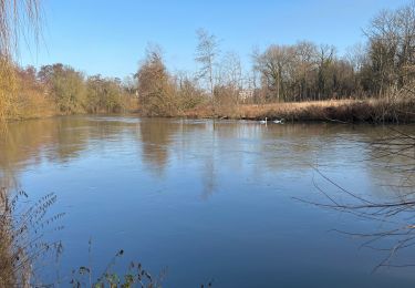
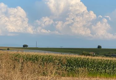
40 photos in total. Please click on a photo to see them all in the gallery.

Positioning

Country:
France
Region :
Grand Est
Department/Province :
Bas-Rhin
Municipality :
Ostwald
Location:
Unknown
Start:(UTM)
404795 ; 5377811 (32U) N.

Trails nearby

Trail Walking Strasbourg - Strasbourg - Centre historique  - Photo
Walking
phil88

Walking

Easy
(3)
Strasbourg, Grand Est, Bas-Rhin, France
8 km | 9.2 km-effort
2h 11min
No
Trail Walking Strasbourg - Untitled - Photo
Walking
EricMathieu

Walking

Very easy
(1)
Strasbourg, Grand Est, Bas-Rhin, France
6.1 km | 7 km-effort
1h 42min
Yes
Trail Walking Ostwald - Tayla - Photo
Walking
26051010

Walking

Easy
Ostwald, Grand Est, Bas-Rhin, France
3.9 km | 4.3 km-effort
53min
No
Trail Walking Ostwald - Lundi  - Photo
Walking
26051010

Walking

Very easy
Ostwald, Grand Est, Bas-Rhin, France
8.4 km | 9.2 km-effort
1h 45min
Yes
Trail Electric bike Ostwald - Promenade Vosges  - Photo
Electric bike
26051010

Electric bike

Very easy
Ostwald, Grand Est, Bas-Rhin, France
82 km | 94 km-effort
4h 33min
Yes
Trail Electric bike Ostwald - Nideck carrefour des Pandours  - Photo
Electric bike
26051010

Electric bike

Medium
Ostwald, Grand Est, Bas-Rhin, France
86 km | 102 km-effort
5h 10min
Yes
Trail Mountain bike Ostwald - Ostwald Etang du loup  - Photo
Mountain bike
26051010

Mountain bike

Medium
Ostwald, Grand Est, Bas-Rhin, France
78 km | 91 km-effort
4h 27min
Yes
Trail Electric bike Ostwald - Ostwald  Mont St Odile. - Photo
Electric bike
26051010

Electric bike

Medium
Ostwald, Grand Est, Bas-Rhin, France
84 km | 102 km-effort
5h 26min
Yes
Trail Electric bike Ostwald - Sans pluie  - Photo
Electric bike
26051010

Electric bike

Easy
Ostwald, Grand Est, Bas-Rhin, France
73 km | 84 km-effort
3h 45min
Yes


Close
My subscriptions