Trail Walking Villar-Loubière - Cime de Turbat.  - Photo
© OpenStreetMap contributors
Length
Length
15.1 km
Max alt
Max alt
2986 m
Uphill gradient
Uphill gradient
1050 m
Km-Effort
Km-Effort  
32 km
Min alt
Min alt
1048 m
Downhill gradient
Downhill gradient
1962 m
Boucle
Boucle
No
Creation date :
2019-10-04 06:06:36.287
Updated on :
2019-10-04 16:17:28.462

(0 Reviews)

Walking
Walking
7h31
Difficulty : Difficult

Scan this QR Code to open this trail in the SityTrail application

FREE GPS app for hiking

Logo SityTrail SityTrail

IGN / Geographical institutes

Download SityTrail from the App Store Download SityTrail from Google Play

Logo SityTrail SityTrail World

The world is yours!

Download SityTrail from the App Store Download SityTrail from Google Play Download SityTrail on Huawei AppGallery

About

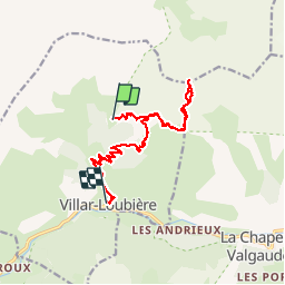
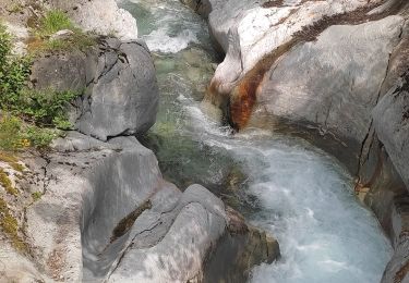
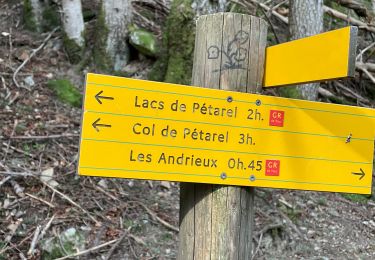
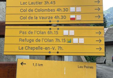
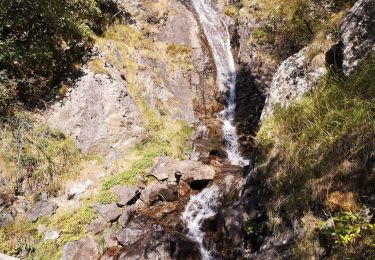
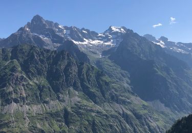
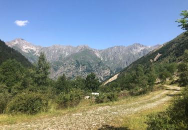
Trail Walking of 15.1 km to be discovered at Provence-Alpes-Côte d'Azur, Hautes-Alpes, Villar-Loubière. This trail is proposed by Dervalmarc.
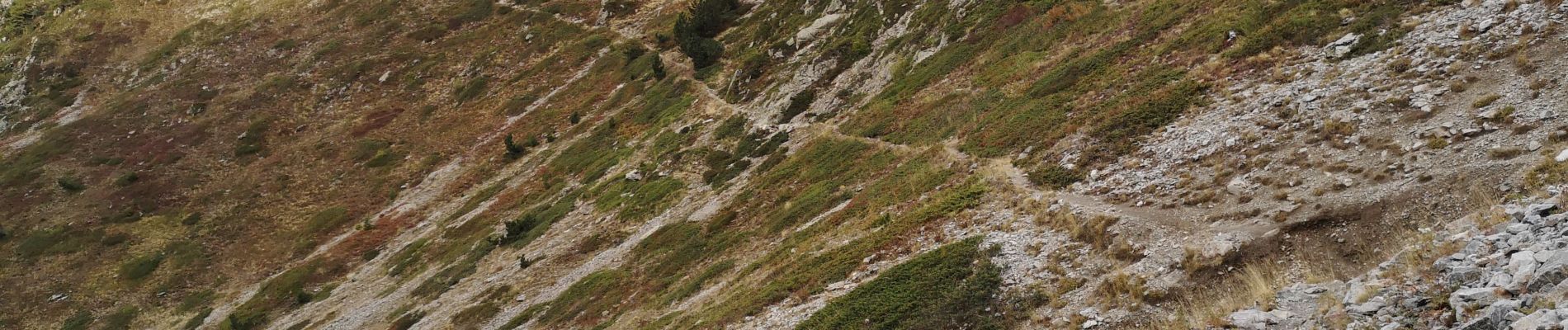
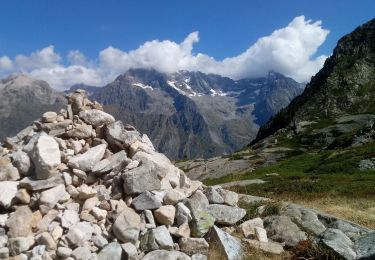
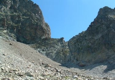
Description

Rando sportive.
Présentant un fort dénivelé a partir du refuge des Souffles.

Elevation profile

Photos

Positioning

Country:
France
Region :
Provence-Alpes-Côte d'Azur
Department/Province :
Hautes-Alpes
Municipality :
Villar-Loubière
Location:
Unknown
Start:(UTM)
274480 ; 4969644 (32T) N.

Trails nearby

Trail Walking La Chapelle-en-Valgaudémar - Les Portes , Les cascades. - Photo
Walking
sereton

Walking

Medium
La Chapelle-en-Valgaudémar, Provence-Alpes-Côte d'Azur, Hautes-Alpes, France
8.1 km | 11 km-effort
2h 25min
Yes
Trail Walking La Chapelle-en-Valgaudémar - Lacs de Pétarel-Col de la Béranne - Photo
Walking
Marco05

Walking

Medium
La Chapelle-en-Valgaudémar, Provence-Alpes-Côte d'Azur, Hautes-Alpes, France
11.1 km | 23 km-effort
7h 0min
Yes
Trail Walking La Chapelle-en-Valgaudémar - Pas de l'Olan - Photo
Walking
Marco05

Walking

Very difficult
La Chapelle-en-Valgaudémar, Provence-Alpes-Côte d'Azur, Hautes-Alpes, France
12.6 km | 34 km-effort
7h 37min
Yes
Trail Walking La Chapelle-en-Valgaudémar - Valgo2 - J2 : Col de Pétarel  - Photo
Walking
ETMU5496

Walking

Very difficult
La Chapelle-en-Valgaudémar, Provence-Alpes-Côte d'Azur, Hautes-Alpes, France
18.8 km | 38 km-effort
5h 40min
No
Trail Walking Villar-Loubière - Valgo2 - J1 : Col des Clochettes - Photo
Walking
ETMU5496

Walking

Difficult
Villar-Loubière, Provence-Alpes-Côte d'Azur, Hautes-Alpes, France
14.6 km | 30 km-effort
4h 12min
Yes
Trail Walking La Chapelle-en-Valgaudémar - Les Lacs de Pétarel - Photo
Walking
patjobou

Walking

Difficult
La Chapelle-en-Valgaudémar, Provence-Alpes-Côte d'Azur, Hautes-Alpes, France
12.5 km | 27 km-effort
5h 43min
Yes
Trail Walking Villar-Loubière - Refuge des souffles.  - Photo
Walking
Dervalmarc

Walking

Medium
Villar-Loubière, Provence-Alpes-Côte d'Azur, Hautes-Alpes, France
4.5 km | 13.7 km-effort
2h 1min
No
Trail Walking La Chapelle-en-Valgaudémar - J4 Valgaudemard - lac et col de petarel - Photo
Walking
ETMU5496

Walking

Difficult
La Chapelle-en-Valgaudémar, Provence-Alpes-Côte d'Azur, Hautes-Alpes, France
17 km | 34 km-effort
6h 18min
Yes
Trail Walking Saint-Maurice-en-Valgodemard - Valgaudemard - chalets de Prentiq - Photo
Walking
ETMU5496

Walking

Medium
Saint-Maurice-en-Valgodemard, Provence-Alpes-Côte d'Azur, Hautes-Alpes, France
12 km | 21 km-effort
3h 38min
Yes


Close
My subscriptions