Trail Walking Sermaise - sermaise 20/325 final - Photo

sermaise 20/325 final

partout a pied et en moto

© OpenStreetMap contributors
Length
Length
20 km
Max alt
Max alt
169 m
Uphill gradient
Uphill gradient
325 m
Km-Effort
Km-Effort  
24 km
Min alt
Min alt
68 m
Downhill gradient
Downhill gradient
320 m
Boucle
Boucle
Yes
Creation date :
2019-10-21 06:37:26.093
Updated on :
2019-10-21 06:38:53.56

(0 Reviews)

Walking
Walking
5h16
Difficulty : Very difficult

Scan this QR Code to open this trail in the SityTrail application

FREE GPS app for hiking

Logo SityTrail SityTrail

IGN / Geographical institutes

Download SityTrail from the App Store Download SityTrail from Google Play

Logo SityTrail SityTrail World

The world is yours!

Download SityTrail from the App Store Download SityTrail from Google Play Download SityTrail on Huawei AppGallery

About

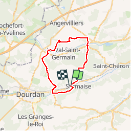
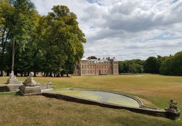
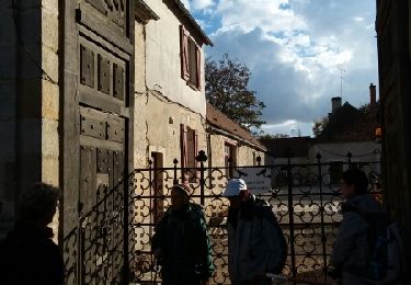
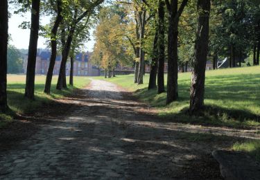
Trail Walking of 20 km to be discovered at Ile-de-France, Essonne, Sermaise. This trail is proposed by les randos d'Olivier.

Description

sermaise, val st germain tennis club le marais sermaisqe

Elevation profile

Positioning

Country:
France
Region :
Ile-de-France
Department/Province :
Essonne
Municipality :
Sermaise
Location:
Unknown
Start:(UTM)
431365 ; 5376274 (31U) N.

Trails nearby

Trail Walking Sermaise - 2018-09-26 Rando Sermaise - Photo
Walking
jchezlemas

Walking

Easy
(1)
Sermaise, Ile-de-France, Essonne, France
12.3 km | 15 km-effort
3h 15min
Yes
Trail Walking Villeconin - Villeconin - Photo
Walking
guydu41

Walking

Medium
Villeconin, Ile-de-France, Essonne, France
8.5 km | 10.9 km-effort
2h 11min
Yes
Trail On foot Boissy-le-Sec - Sur les traces de la Renarde - Photo
On foot
PRO

On foot

Easy
Boissy-le-Sec, Ile-de-France, Essonne, France
6.3 km | 7.4 km-effort
1h 40min
No
Trail Nordic walking Saint-Chéron - carrière Saint chérion - Photo
Nordic walking
PascalROBINET

Nordic walking

Very easy
Saint-Chéron, Ile-de-France, Essonne, France
10.3 km | 12.3 km-effort
2h 32min
Yes
Trail Walking Saint-Chéron - Saint Chéron - Lardy - Photo
Walking
ABICHE

Walking

Very easy
Saint-Chéron, Ile-de-France, Essonne, France
18 km | 22 km-effort
5h 0min
No
Trail Walking Dourdan - Dourdan - Saint Chéron - Photo
Walking
ABICHE

Walking

Very easy
Dourdan, Ile-de-France, Essonne, France
21 km | 26 km-effort
5h 10min
No
Trail Walking Dourdan - Dourdan en automne - Photo
Walking
gal75len

Walking

Medium
Dourdan, Ile-de-France, Essonne, France
20 km | 24 km-effort
6h 8min
Yes
Trail Walking Saint-Chéron - Autour de Saint Chéron - Photo
Walking
tracegps

Walking

Medium
Saint-Chéron, Ile-de-France, Essonne, France
24 km | 30 km-effort
5h 0min
Yes
Trail Walking Dourdan - Alentours de Dourdan - Photo
Walking
PatrickMatuszewski

Walking

Medium
Dourdan, Ile-de-France, Essonne, France
25 km | 30 km-effort
6h 45min
Yes


Close
My subscriptions