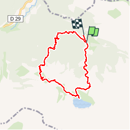
Trail Walking Bagnères-de-Bigorre - Peyrelade - Photo
 ponthus
ponthus

User

© OpenStreetMap contributors
Length
Length
7.8 km
Max alt
Max alt
1963 m
Uphill gradient
Uphill gradient
621 m
Km-Effort
Km-Effort  
16.1 km
Min alt
Min alt
1316 m
Downhill gradient
Downhill gradient
642 m
Boucle
Boucle
No
Creation date :
2019-10-26 08:38:24.0
Updated on :
2019-10-26 13:50:54.834

(0 Reviews)

Walking
Walking
5h10
Difficulty : Difficult

Scan this QR Code to open this trail in the SityTrail application

FREE GPS app for hiking

Logo SityTrail SityTrail

IGN / Geographical institutes

Download SityTrail from the App Store Download SityTrail from Google Play

Logo SityTrail SityTrail World

The world is yours!

Download SityTrail from the App Store Download SityTrail from Google Play Download SityTrail on Huawei AppGallery

About

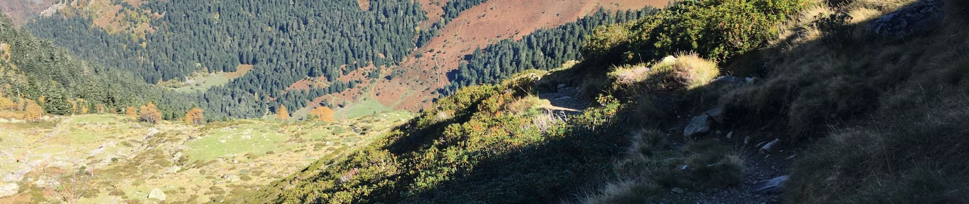
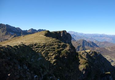
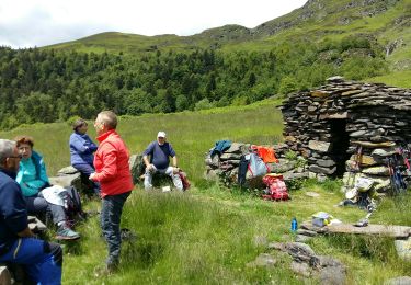
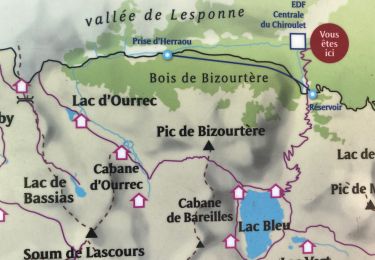
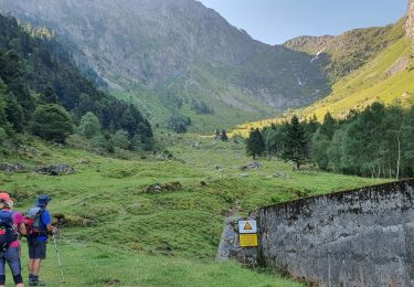
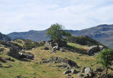
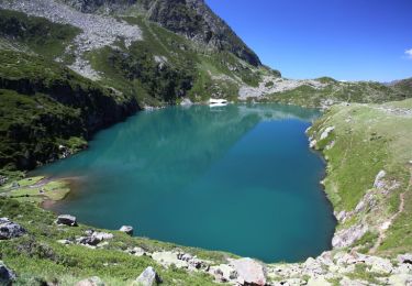
Trail Walking of 7.8 km to be discovered at Occitania, Hautespyrenees, Bagnères-de-Bigorre. This trail is proposed by ponthus.

Description

Rando top

Elevation profile

Photos

Positioning

Country:
France
Region :
Occitania
Department/Province :
Hautespyrenees
Municipality :
Bagnères-de-Bigorre
Location:
Unknown
Start:(UTM)
264826 ; 4760166 (31T) N.

Trails nearby

Trail Walking Bagnères-de-Bigorre - Le pic de Montaigu - Photo
Walking
tracegps

Walking

Difficult
(1)
Bagnères-de-Bigorre, Occitania, Hautespyrenees, France
9 km | 25 km-effort
6h 0min
Yes
Trail Walking Bagnères-de-Bigorre - Lac Bleu et pic de Bizourtère (2311m)  - Photo
Walking
tracegps

Walking

Difficult
(1)
Bagnères-de-Bigorre, Occitania, Hautespyrenees, France
15 km | 32 km-effort
5h 0min
Yes
Trail Walking Bagnères-de-Bigorre - LESPONNE courtaou  de la lit G3 B fait le 12/06/2020 - Photo
Walking
GUIDE
marmotte65

Walking

Medium
Bagnères-de-Bigorre, Occitania, Hautespyrenees, France
6.2 km | 12.1 km-effort
4h 28min
Yes
Trail Walking Bagnères-de-Bigorre - Le lac bleu et le lac outrec - Photo
Walking
fred47

Walking

Very difficult
Bagnères-de-Bigorre, Occitania, Hautespyrenees, France
28 km | 65 km-effort
7h 13min
No
Trail Walking Bagnères-de-Bigorre - etg bleu-col de bareille-pic bizoutère-lac d'Ourec depuis le Chiroulet - Photo
Walking
chrisgps

Walking

Medium
Bagnères-de-Bigorre, Occitania, Hautespyrenees, France
16 km | 33 km-effort
7h 42min
Yes
Trail Walking Bagnères-de-Bigorre - Le montaigu - Photo
Walking
GUIDE
lhomme.ph

Walking

Difficult
Bagnères-de-Bigorre, Occitania, Hautespyrenees, France
9.3 km | 25 km-effort
7h 41min
Yes
Trail On foot Bagnères-de-Bigorre - Le Lac de Peyrelade - Photo
On foot
PRO

On foot

Easy
Bagnères-de-Bigorre, Occitania, Hautespyrenees, France
7.5 km | 15.9 km-effort
3h 37min
No
Trail Walking Bagnères-de-Bigorre - Le Cap de Labasset et le lac de Peyrelade - Photo
Walking
tracegps

Walking

Medium
Bagnères-de-Bigorre, Occitania, Hautespyrenees, France
9.8 km | 20 km-effort
6h 0min
Yes
Trail Walking Bagnères-de-Bigorre - Le lac Bleu et le Pic de Merlheu - Le Chiroulet - Photo
Walking
tracegps

Walking

Difficult
Bagnères-de-Bigorre, Occitania, Hautespyrenees, France
18.7 km | 40 km-effort
9h 15min
Yes


Close
My subscriptions