Trail Walking Chessy - Chessy-les-Mines (version 2) - 18 km - D. 326 m - Photo

Chessy-les-Mines (version 2) - 18 km - D. 326 m

© OpenStreetMap contributors
Length
Length
17.6 km
Max alt
Max alt
364 m
Uphill gradient
Uphill gradient
315 m
Km-Effort
Km-Effort  
22 km
Min alt
Min alt
210 m
Downhill gradient
Downhill gradient
315 m
Boucle
Boucle
Yes
Creation date :
2019-11-25 08:12:48.0
Updated on :
2022-01-15 16:15:20.621

(0 Reviews)

Walking
Walking
5h42
Difficulty : Medium

Scan this QR Code to open this trail in the SityTrail application

FREE GPS app for hiking

Logo SityTrail SityTrail

IGN / Geographical institutes

Download SityTrail from the App Store Download SityTrail from Google Play

Logo SityTrail SityTrail World

The world is yours!

Download SityTrail from the App Store Download SityTrail from Google Play Download SityTrail on Huawei AppGallery

About

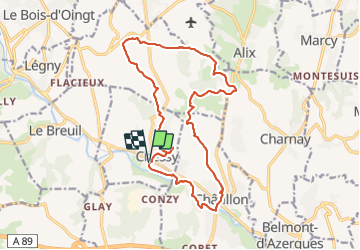
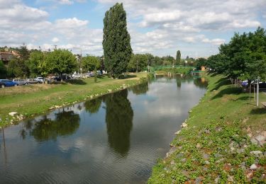
Trail Walking of 17.6 km to be discovered at Auvergne-Rhône-Alpes, Rhône, Chessy. This trail is proposed by Thomasdanielle.

Description

D/A : Parking après le passage à niveau en face de l'école.
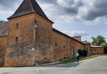
Magnifique village en Beaujolais.
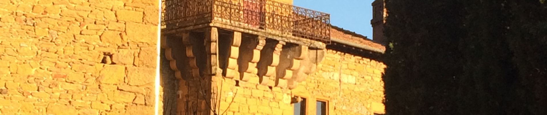
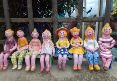
En passant sous le petit tunnel (passage piétons obligés) on  peut voir  de  jolies peintures sur les mûrs.
Nous avons Pique-niqué au km 9,77  à la sortie du bois.
Très belle randonnée, réalisée le 25/11/2019, cette journée étant bien ensoleillé.
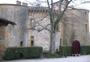
Passage très agréable devant le château et la Chapelle  en pierres dorées.
Cette marche a été très appréciée par les 25 personnes présentent, elle sera refaite dans les mois a venir mais toujours au printemps, Automne ou  hiver. En été  nous éviterons les grosses chaleurs.

Elevation profile

Photos

Positioning

Country:
France
Region :
Auvergne-Rhône-Alpes
Department/Province :
Rhône
Municipality :
Chessy
Location:
Unknown
Start:(UTM)
625740 ; 5082630 (31T) N.

Trails nearby

Trail Mountain bike Lozanne - La 5ème Vélozannaise (2014-VTT-45km) - Lozanne - Photo
Mountain bike
tracegps

Mountain bike

Difficult
(1)
Lozanne, Auvergne-Rhône-Alpes, Rhône, France
45 km | 59 km-effort
3h 45min
Yes
Trail Horseback riding Bully - BULLY  nord 29k 38KF - Photo
Horseback riding
azipat

Horseback riding

Difficult
(1)
Bully, Auvergne-Rhône-Alpes, Rhône, France
30 km | 39 km-effort
5h 9min
Yes
Trail On foot Légny - De Saint Vérand à Bagnols - Photo
On foot
PRO

On foot

Easy
Légny, Auvergne-Rhône-Alpes, Rhône, France
7.4 km | 10.3 km-effort
2h 20min
No
Trail On foot Saint-Jean-des-Vignes - De Bagnols à Lozanne - Photo
On foot
PRO

On foot

Easy
Saint-Jean-des-Vignes, Auvergne-Rhône-Alpes, Rhône, France
4 km | 5 km-effort
1h 7min
No
Trail On foot Lozanne - De Lozanne à Marcy - Photo
On foot
PRO

On foot

Easy
Lozanne, Auvergne-Rhône-Alpes, Rhône, France
12.2 km | 15.6 km-effort
3h 32min
No
Trail Nordic walking Bagnols - bagnol - Photo
Nordic walking
isabelle.xavier

Nordic walking

Very easy
(1)
Bagnols, Auvergne-Rhône-Alpes, Rhône, France
6.8 km | 8.4 km-effort
1h 40min
Yes
Trail Walking Saint-Jean-des-Vignes - A_ST JEAN DES VIGNES 69380 Pierre Folle - Fontainebleau - Photo
Walking
ANDREJAC

Walking

Easy
(1)
Saint-Jean-des-Vignes, Auvergne-Rhône-Alpes, Rhône, France
8 km | 11 km-effort
3h 0min
Yes
Trail Walking Chessy - Chessy à Bagnols - Photo
Walking
Jean-Marc C

Walking

Difficult
(1)
Chessy, Auvergne-Rhône-Alpes, Rhône, France
12.5 km | 15.8 km-effort
3h 35min
Yes
Trail Walking Charnay - Charnay (12 km - D. 330 m) - Photo
Walking
Thomasdanielle

Walking

Easy
Charnay, Auvergne-Rhône-Alpes, Rhône, France
12.5 km | 16.9 km-effort
3h 7min
Yes


Close
My subscriptions