


Trois Epis - Roche du Corbeau - Frauenkopf - Tête du Sanglier - Obschel - Meierhof et retour par le GR 532 et le sentier de découvertes

patrickbeyrath
User
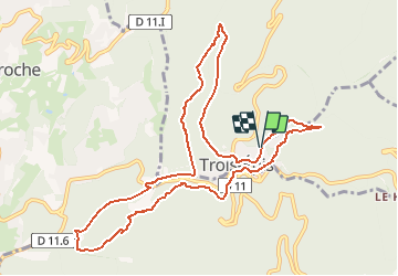

Length
11.2 km

Max alt
778 m

Uphill gradient
291 m
Km-Effort
15.1 km

Min alt
614 m

Downhill gradient
290 m
Boucle
Yes
Creation date :
2020-06-05 06:10:57.525
Updated on :
2020-06-05 06:45:55.949
--
Difficulty : Medium

FREE GPS app for hiking
 SityTrail
IGN / Geographical institutes
SityTrail Plus
The world is yours!
About
Trail On foot of 11.2 km to be discovered at Grand Est, Haut-Rhin, Ammerschwihr. This trail is proposed by patrickbeyrath.
Positioning
Country:
France
Region :
Grand Est
Department/Province :
Haut-Rhin
Municipality :
Ammerschwihr
Location:
Unknown
Start:(Dec)
Start:(UTM)
368583 ; 5329108 (32U) N.
Comments