


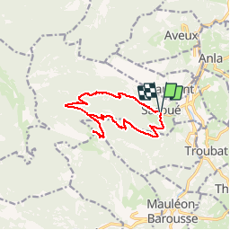

10.2 km | 17.1 km-effort


User GUIDE


FREE GPS app for hiking
 SityTrail
IGN / Geographical institutes
SityTrail World
The world is yours!
Trail Walking of 14.2 km to be discovered at Occitania, Hautespyrenees, Sacoué. This trail is proposed by lhomme.ph.
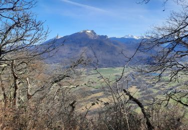
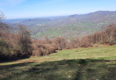
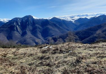
Point de vue superbe sur la Barousse et la chaine des Pyrénées

Walking
Walking
On foot

Walking
Walking
Walking
Walking
Walking
Walking
j'attends pour voir qd même de l'avoir utiliser, donc pas faire caga