Trail Walking Junas - Entre Junas et Aujargues - Photo

Entre Junas et Aujargues

 randotines
randotines

User GUIDE

© OpenStreetMap contributors
Length
Length
7.9 km
Max alt
Max alt
93 m
Uphill gradient
Uphill gradient
106 m
Km-Effort
Km-Effort  
9.4 km
Min alt
Min alt
38 m
Downhill gradient
Downhill gradient
107 m
Boucle
Boucle
Yes
Creation date :
2014-12-10 00:00:00.0
Updated on :
2014-12-10 00:00:00.0

(0 Reviews)

Walking
Walking
2h02
Difficulty : Easy

Scan this QR Code to open this trail in the SityTrail application

FREE GPS app for hiking

Logo SityTrail SityTrail

IGN / Geographical institutes

Download SityTrail from the App Store Download SityTrail from Google Play

Logo SityTrail SityTrail World

The world is yours!

Download SityTrail from the App Store Download SityTrail from Google Play Download SityTrail on Huawei AppGallery

About

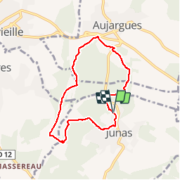
Trail Walking of 7.9 km to be discovered at Occitania, Gard, Junas. This trail is proposed by randotines.

Description

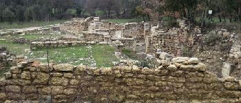
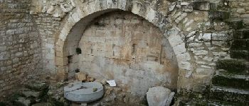
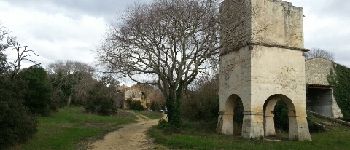
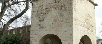
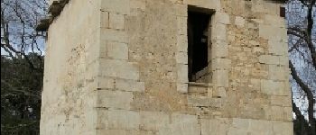
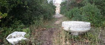
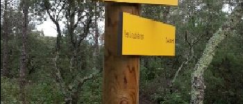
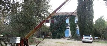
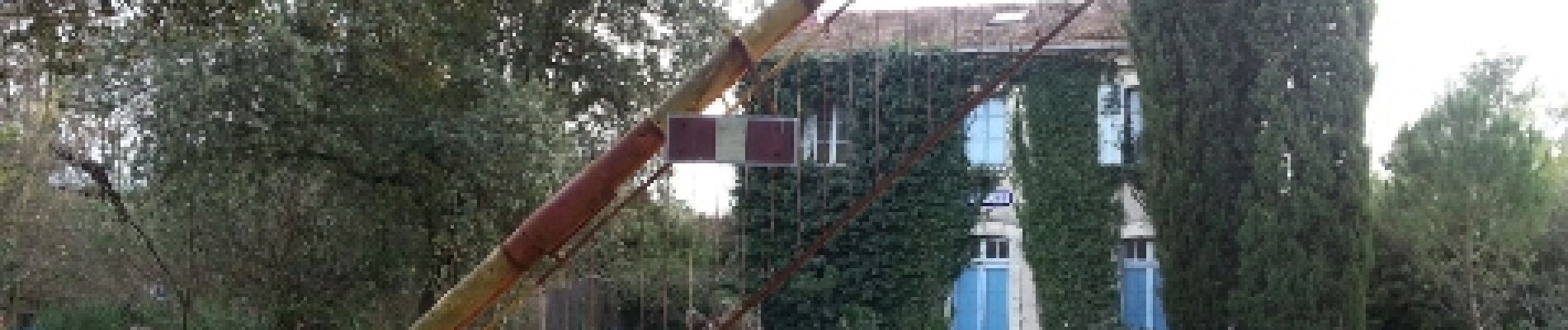
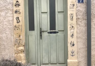
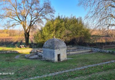
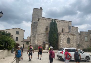
Belle rando facile balisée "jaune" au départ de Junas (Parking suivre "carrières",  magnifiques ! qu'on peut visiter avant ou après la rando ) et découverte des ruines d'un vieux moulin médiéval à eau. Sur le parcours, un très beau pigeonnier datant de 1699 qui était rattaché au château d'Aujargues. A voir également à Junas : Eglise Saint-Benoît , à l'origine médiévale édifiée sur une petite hauteur , reconstruite à la fin du 17ème siècle . Cloche non déchiffrée .
Temple protestant de style néoclassique édifié en 1821 , clocher pignon postérieur abritant une belle cloche du fondeur Eugène Beaudouin à Marseille ( fin 19ème )
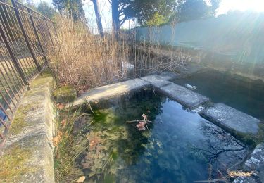
Beffroi communal ( édifié en 1772 , quasiment frère jumeau de celui de Congénies , il fût entièrement reconstruit en 1928 après avoir été totalement détruit par la foudre en mars 1927 ) . Il abrite encore de nos jours une très ancienne cloche au sein de son campanile constitué de quatre arceaux de fonte de fer , semblant remonter au milieu du 17ème siècle ( apparemment 1651 )Anciens lavoirs de Corbière Ancien moulin à eau médiéval de Corbière et ancien moulin à vent
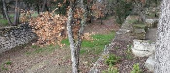
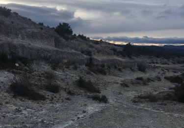
Anciennes carrières antiques où se déroulent le désormais célèbre festival de jazz en juillet...vous voyez, il y a de quoi s'occuper ! Bonne balade.

Elevation profile

Photos

Points of interest

Point of interest Junas - Point 1 - Photo
randotines
JUNAS 
Point of interest Junas - Ruines du moulin à eau - Photo
randotines
Point of interest Junas - Moulin à eau  - Photo
randotines
Point of interest Junas - Point 5 - Photo
randotines
JUNAS 
Point of interest Junas - Point 7 - Photo
randotines
JUNAS 
Point of interest Aujargues - Point 8 - Photo
randotines
AUJARGUES 
Point of interest Aujargues - Point 9 - Photo
randotines
AUJARGUES 
Point of interest Aujargues - Point 10 - Photo
randotines
AUJARGUES 
Point of interest Aujargues - Point 11 - Photo
randotines
AUJARGUES 
Point of interest Aujargues - Point 12 - Photo
randotines
AUJARGUES 
Point of interest Villevieille - Point 13 - Photo
randotines
VILLEVIEILLE 

Positioning

Country:
France
Region :
Occitania
Department/Province :
Gard
Municipality :
Junas
Location:
Unknown
Start:(UTM)
590231 ; 4847419 (31T) N.

Trails nearby

Trail Walking Sommières -  SOMMIERES 30 - VILLEVIEILLE châteaux- JUNAS les carrières  - Photo
Walking
jeff66

Walking

Medium
(2)
Sommières, Occitania, Gard, France
14 km | 16.9 km-effort
2h 34min
Yes
Trail Walking Sommières - G3_Sommières Villevieille Junas_ 19/02/2024 - Photo
Walking
mamyln

Walking

Difficult
(2)
Sommières, Occitania, Gard, France
13.4 km | 16.2 km-effort
3h 41min
Yes
Trail Walking Sommières - Autour de Villevielle 30 - Photo
Walking
guignier

Walking

Easy
(2)
Sommières, Occitania, Gard, France
10.5 km | 12.3 km-effort
3h 0min
Yes
Trail Walking Junas - Aubais  - Photo
Walking
Galoche

Walking

Very easy
Junas, Occitania, Gard, France
6.4 km | 7.8 km-effort
1h 39min
Yes
Trail Walking Souvignargues - Saint Étienne d’Escattes - Photo
Walking
GUIDE
Roger Philippe Wallez

Walking

Very difficult
Souvignargues, Occitania, Gard, France
16.9 km | 22 km-effort
4h 58min
Yes
Trail Walking Salinelles - salinelles-pondres-souvignargues-fontanes - Photo
Walking
v.rabot

Walking

Medium
Salinelles, Occitania, Gard, France
14.7 km | 17.2 km-effort
4h 14min
Yes
Trail Walking Sommières - Les matches de géants  - Photo
Walking
gscholasch

Walking

Easy
Sommières, Occitania, Gard, France
48 km | 67 km-effort
3h 29min
No
Trail Walking Saussines - Saussine, sentier des Romains - Photo
Walking
daniel34

Walking

Very easy
Saussines, Occitania, Hérault, France
12.2 km | 14 km-effort
3h 32min
Yes
Trail Walking Saussines - Saussines Les Capitelles de la Benovie - Photo
Walking
boudpn

Walking

Medium
Saussines, Occitania, Hérault, France
10 km | 11.3 km-effort
4h 48min
Yes


Close
My subscriptions