


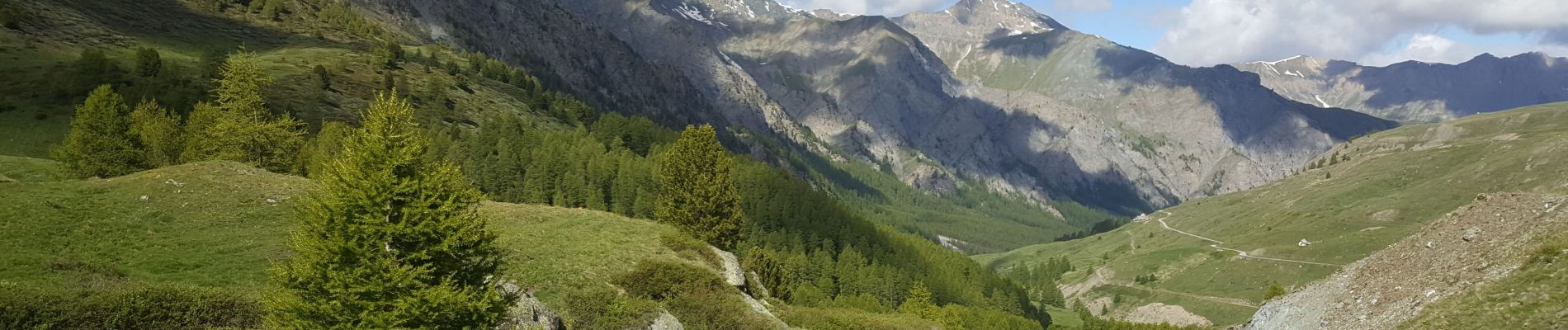
st Veran - refuge Agnel col à 2880

jeff2
User
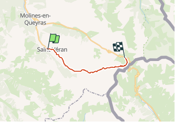

Length
13.4 km

Max alt
2880 m

Uphill gradient
1028 m
Km-Effort
25 km

Min alt
1926 m

Downhill gradient
385 m
Boucle
No
Creation date :
2020-06-19 06:16:14.885
Updated on :
2020-06-20 16:56:52.872
5h27
Difficulty : Medium

FREE GPS app for hiking
 SityTrail
IGN / Geographical institutes
SityTrail Plus
The world is yours!
About
Trail Fishing of 13.4 km to be discovered at Provence-Alpes-Côte d'Azur, Hautes-Alpes, Saint-Véran. This trail is proposed by jeff2.
Description
Col de la chamoussiere 2880
Deja plus facile
Ça ira encore mieux demain
Belle balade
Photos


Positioning
Country:
France
Region :
Provence-Alpes-Côte d'Azur
Department/Province :
Hautes-Alpes
Municipality :
Saint-Véran
Location:
Unknown
Start:(Dec)
Start:(UTM)
330665 ; 4951737 (32T) N.
Comments