Trail Walking Mur-sur-Allier - Mezel_PuyDeMur_T - Photo
 force
force

User

© OpenStreetMap contributors
Length
Length
12.8 km
Max alt
Max alt
597 m
Uphill gradient
Uphill gradient
339 m
Km-Effort
Km-Effort  
17.3 km
Min alt
Min alt
312 m
Downhill gradient
Downhill gradient
336 m
Boucle
Boucle
Yes
Creation date :
2014-12-10 00:00:00.0
Updated on :
2014-12-10 00:00:00.0

(2 Reviews)

Walking
Walking
3h46
Difficulty : Easy

Scan this QR Code to open this trail in the SityTrail application

FREE GPS app for hiking

Logo SityTrail SityTrail

IGN / Geographical institutes

Download SityTrail from the App Store Download SityTrail from Google Play

Logo SityTrail SityTrail World

The world is yours!

Download SityTrail from the App Store Download SityTrail from Google Play Download SityTrail on Huawei AppGallery

About

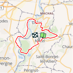
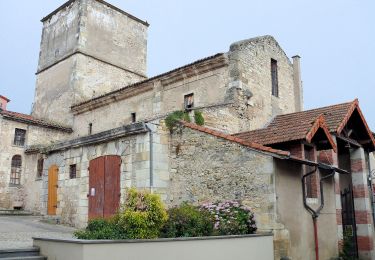
Trail Walking of 12.8 km to be discovered at Auvergne-Rhône-Alpes, Puy-de-Dôme, Mur-sur-Allier. This trail is proposed by force.

Description

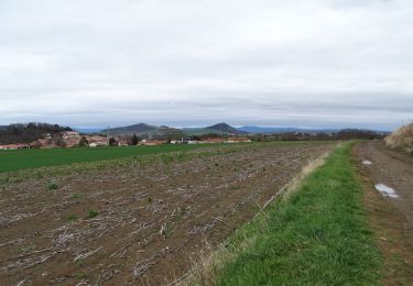
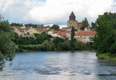
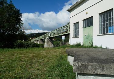
Belle vue sur l'Allier

Elevation profile

Photos

Positioning

Country:
France
Region :
Auvergne-Rhône-Alpes
Department/Province :
Puy-de-Dôme
Municipality :
Mur-sur-Allier
Location:
Unknown
Start:(UTM)
518852 ; 5066866 (31T) N.

Comments

Please log in to post a review or rate the element


descente du Puy de mur très difficile un chemin introuvable obligé de prendre la route 5 h 30 de marche 25 km et non 16


Trails nearby

Trail On foot Saint-Georges-sur-Allier - Saint-Georges-sur-Allier - Photo
On foot
guy63

On foot

Medium
(1)
Saint-Georges-sur-Allier, Auvergne-Rhône-Alpes, Puy-de-Dôme, France
5.6 km | 7.7 km-effort
2h 30min
Yes
Trail Walking Le Cendre - Le_Cendre_Tour_1 - Photo
Walking
GUIDE
jagarnier

Walking

Easy
(1)
Le Cendre, Auvergne-Rhône-Alpes, Puy-de-Dôme, France
8.2 km | 10.1 km-effort
2h 30min
Yes
Trail On foot Pont-du-Château - Le Chemin des Batteliers - Photo
On foot
PRO

On foot

Easy
Pont-du-Château, Auvergne-Rhône-Alpes, Puy-de-Dôme, France
4 km | 5 km-effort
1h 7min
Yes
Trail On foot Chauriat - Les Coteaux de Chauriat - Photo
On foot
PRO

On foot

Easy
Chauriat, Auvergne-Rhône-Alpes, Puy-de-Dôme, France
10 km | 13.3 km-effort
3h 1min
Yes
Trail On foot Le Cendre - De l'Auzon a Gondole - Photo
On foot
PRO

On foot

Easy
Le Cendre, Auvergne-Rhône-Alpes, Puy-de-Dôme, France
6.8 km | 7.7 km-effort
1h 44min
Yes
Trail On foot Pont-du-Château - De Marchal a Cortal - Photo
On foot
PRO

On foot

Easy
Pont-du-Château, Auvergne-Rhône-Alpes, Puy-de-Dôme, France
5.8 km | 6.7 km-effort
1h 31min
Yes
Trail On foot Cournon-d'Auvergne - Bords d'Allier - Photo
On foot
PRO

On foot

Easy
Cournon-d'Auvergne, Auvergne-Rhône-Alpes, Puy-de-Dôme, France
6.6 km | 7.2 km-effort
1h 37min
Yes
Trail Mountain bike Pont-du-Château - La Tonytruante - Pont du Château - Photo
Mountain bike
tracegps

Mountain bike

Medium
(1)
Pont-du-Château, Auvergne-Rhône-Alpes, Puy-de-Dôme, France
47 km | 58 km-effort
2h 30min
Yes
Trail Mountain bike Cournon-d'Auvergne - velo enfant cournon 2 - Photo
Mountain bike
PAKITO631

Mountain bike

Easy
(1)
Cournon-d'Auvergne, Auvergne-Rhône-Alpes, Puy-de-Dôme, France
9.8 km | 10.8 km-effort
1h 0min
Yes


Close
My subscriptions