Trail Walking Arrens-Marsous - 2020-08-06_16h24m34_les-lacs-de-batcrabere - Photo

2020-08-06_16h24m34_les-lacs-de-batcrabere

© OpenStreetMap contributors
Length
Length
13.5 km
Max alt
Max alt
2209 m
Uphill gradient
Uphill gradient
828 m
Km-Effort
Km-Effort  
25 km
Min alt
Min alt
1476 m
Downhill gradient
Downhill gradient
828 m
Boucle
Boucle
Yes
Creation date :
2020-08-06 14:24:34.591
Updated on :
2020-09-07 15:02:11.069

(0 Reviews)

Walking
Walking
4h56
Difficulty : Difficult

Scan this QR Code to open this trail in the SityTrail application

FREE GPS app for hiking

Logo SityTrail SityTrail

IGN / Geographical institutes

Download SityTrail from the App Store Download SityTrail from Google Play

Logo SityTrail SityTrail World

The world is yours!

Download SityTrail from the App Store Download SityTrail from Google Play Download SityTrail on Huawei AppGallery

About

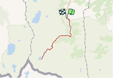
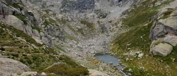
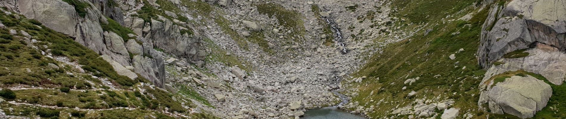
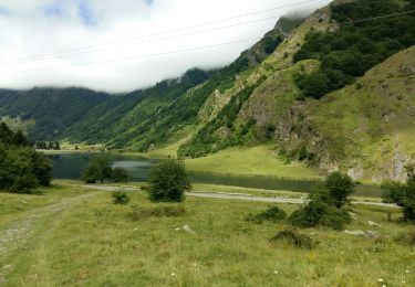
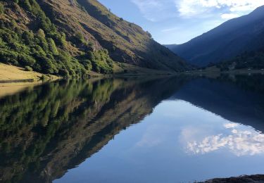
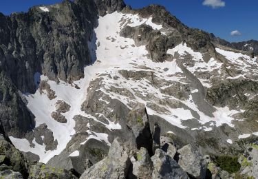
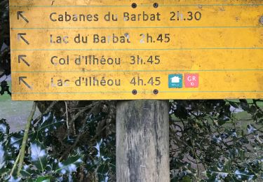
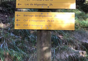
Trail Walking of 13.5 km to be discovered at Occitania, Hautespyrenees, Arrens-Marsous. This trail is proposed by neoroll44.

Description

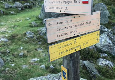
Depuis la maison du parc (parking) au dessus du barrage du Tech.

Elevation profile

Photos

Points of interest

Point of interest Arrens-Marsous - Cascade - Photo
neoroll44
ARRENS-MARSOUS 
Point of interest Arrens-Marsous - La c de Batcrabère - Photo
neoroll44
ARRENS-MARSOUS 

Positioning

Country:
France
Region :
Occitania
Department/Province :
Hautespyrenees
Municipality :
Arrens-Marsous
Location:
Unknown
Start:(UTM)
722907 ; 4751429 (30T) N.

Trails nearby

Trail Walking Estaing - ESTAING  RS le der de 2022 - Photo
Walking
GUIDE
marmotte65

Walking

Easy
Estaing, Occitania, Hautespyrenees, France
3.6 km | 5.1 km-effort
1h 5min
Yes
Trail Walking Estaing - Ruines et lac de Liantran  - Photo
Walking
jaja64

Walking

Easy
Estaing, Occitania, Hautespyrenees, France
17.7 km | 28 km-effort
6h 45min
Yes
Trail Walking Arrens-Marsous - pic de cristayet - Photo
Walking
PVERTICAL

Walking

Difficult
Arrens-Marsous, Occitania, Hautespyrenees, France
15.7 km | 35 km-effort
9h 32min
Yes
Trail Walking Estaing - Pyrénées jour 4 - Photo
Walking
dudu85

Walking

Estaing, Occitania, Hautespyrenees, France
12.6 km | 22 km-effort
4h 6min
Yes
Trail Walking Arrens-Marsous - Pyrénées jour 3 - Photo
Walking
dudu85

Walking

Arrens-Marsous, Occitania, Hautespyrenees, France
9.7 km | 22 km-effort
5h 41min
Yes
Trail Walking Arrens-Marsous - Pyrénées jour 2 - Photo
Walking
dudu85

Walking

Arrens-Marsous, Occitania, Hautespyrenees, France
13 km | 23 km-effort
7h 0min
Yes
Trail Walking Arrens-Marsous - Tech - Ausseila. - Photo
Walking
pffrench

Walking

Medium
Arrens-Marsous, Occitania, Hautespyrenees, France
14.3 km | 28 km-effort
8h 39min
Yes
Trail Walking Arrens-Marsous - Refuge de LARRIBET - Photo
Walking
bernardbelmas

Walking

Medium
Arrens-Marsous, Occitania, Hautespyrenees, France
12.2 km | 20 km-effort
5h 57min
Yes
Trail Walking Estaing - Circulaire lac Estaing par brèche de Hourat - Photo
Walking
pffrench

Walking

Very difficult
Estaing, Occitania, Hautespyrenees, France
23 km | 46 km-effort
15h 45min
Yes


Close
My subscriptions