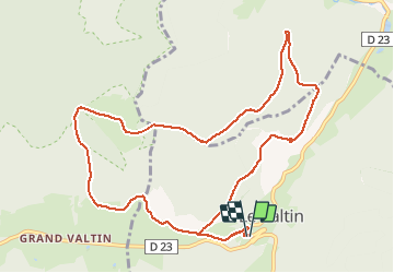
8.5 km | 0 m-effort
Le Valtin
oscar1
User
Length
11.6 km
Max alt
1127 m
Uphill gradient
594 m
Km-Effort
19.5 km
Min alt
762 m
Downhill gradient
594 m
Boucle
Yes
Creation date :
2020-08-09 07:49:50.957
Updated on :
2020-08-09 20:18:53.848
3h02
Difficulty : Medium
FREE GPS app for hiking
About
Trail Walking of 11.6 km to be discovered at Grand Est, Vosges, Le Valtin. This trail is proposed by oscar1.
Description
Au départ montée assez raide
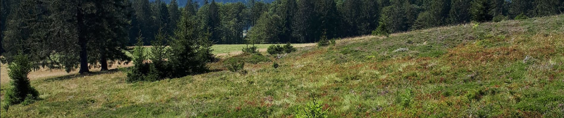
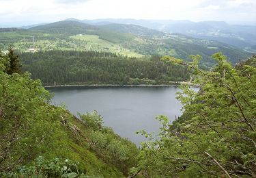
Positioning
Country:
France
Region :
Grand Est
Department/Province :
Vosges
Municipality :
Le Valtin
Location:
Unknown
Start:(Dec)
Start:(UTM)
352593 ; 5328908 (32U) N.
Comments
Trails nearby
Tour du belvedere avec le passage sur les crêtes
Walking
Very easy
(2)
Stosswihr,
Grand Est,
Haut-Rhin,
France
2h 28min
Yes
Totom 4 lacs
Other activity
Medium
(1)
Soultzeren,
Grand Est,
Haut-Rhin,
France
15.6 km | 26 km-effort
4h 37min
Yes
Les Hirschsteine
Walking
Difficult
(1)
Le Valtin,
Grand Est,
Vosges,
France
16.1 km | 25 km-effort
6h 28min
Yes
La vallée de Belbriette - Ban-sur-Meurthe-Clefcy
Walking
Medium
(2)
Ban-sur-Meurthe-Clefcy,
Grand Est,
Vosges,
France
9.8 km | 12.6 km-effort
2h 30min
Yes
Tanet-Gazon du faing par lac vert et retour sommet du Tanet
Walking
Medium
(1)
Soultzeren,
Grand Est,
Haut-Rhin,
France
10 km | 15.6 km-effort
4h 24min
Yes
raquettes
Snowshoes
Very easy
(1)
Le Valtin,
Grand Est,
Vosges,
France
6.6 km | 9.4 km-effort
3h 8min
No
Le cirque glaciaire du Frankenthal - Sentier des Roches -Gps
Walking
Difficult
(3)
Stosswihr,
Grand Est,
Haut-Rhin,
France
9 km | 16.1 km-effort
4h 10min
Yes
20. Les belvédères des trois lacs
On foot
Easy
Le Valtin,
Grand Est,
Vosges,
France
4.5 km | 6.6 km-effort
1h 29min
No
sortie ski de fond les 3 fourgs 23022019
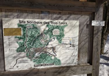
Cross-country skiing
Easy
Xonrupt-Longemer,
Grand Est,
Vosges,
France
5.5 km | 6.9 km-effort
1h 47min
Yes