


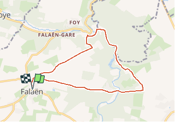

18.3 km | 24 km-effort


User


FREE GPS app for hiking
 SityTrail
IGN / Geographical institutes
SityTrail World
The world is yours!
Trail Trail of 8.1 km to be discovered at Wallonia, Namur, Onhaye. This trail is proposed by Will Stevens.
https://www.cirkwi.com/fr/circuit/184865-a-pied-vers-montaigle
Depuis Falaën, l’un des « Plus Beaux Villages de Wallonie », la route sinueuse nous
mène à travers les dépressions du Condroz namurois. Plus loin, voici un bois, passant par la Héronnière. Suivons une route empierrée : soudain sur les hauteurs voilà qu’apparaissent les ruines de la forteresse.
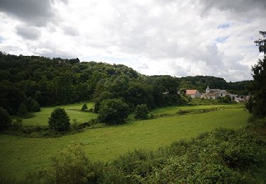
La balade entre maintenant dans un magnifique sous-bois constellé de fleurs : on s’y coucherait avec plaisir...
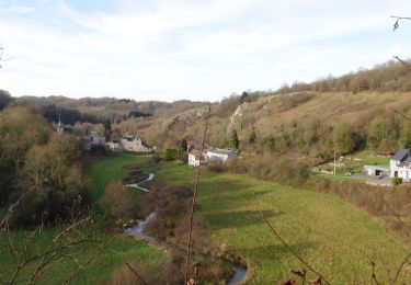
En suivant le ruisseau du Floyon baigné de lumière, nous rejoignons la ferme de l’ancienne seigneurie. Désormais le chemin fléchit et pique vers Falaën où se dresse la
ferme-château, bâtie en 1672. Elle a gardé un équilibre parfait entre sa vocation agricole et défensive, avec son plan quadrilatère, les trois hautes tours et le pont-levis sont remarquablement conservés.
Retrouvez cette balade ainsi que d'autres autour de châteaux: https://walloniebelgiquetourisme.be/fr-be/3/jaime/patrimoine-et-culture/chateaux/balades-chateaux

Walking

Walking

Walking

Walking
Walking

Walking

Walking

Walking
Walking