


2020 09 Taennchel

staubalex
User
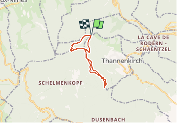

Length
9.1 km

Max alt
959 m

Uphill gradient
367 m
Km-Effort
14 km

Min alt
736 m

Downhill gradient
370 m
Boucle
Yes
Creation date :
2020-08-28 17:15:35.049
Updated on :
2020-08-28 17:17:46.858
2h00
Difficulty : Very easy

FREE GPS app for hiking
 SityTrail
IGN / Geographical institutes
SityTrail Plus
The world is yours!
About
Trail On foot of 9.1 km to be discovered at Grand Est, Haut-Rhin, Rodern. This trail is proposed by staubalex.
Positioning
Country:
France
Region :
Grand Est
Department/Province :
Haut-Rhin
Municipality :
Rodern
Location:
Unknown
Start:(Dec)
Start:(UTM)
372438 ; 5344882 (32U) N.
Comments