


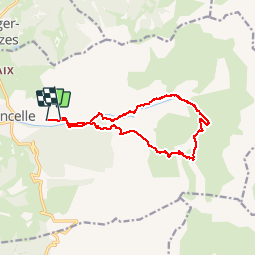

7.4 km | 12.1 km-effort


User


FREE GPS app for hiking
 SityTrail
IGN / Geographical institutes
SityTrail World
The world is yours!
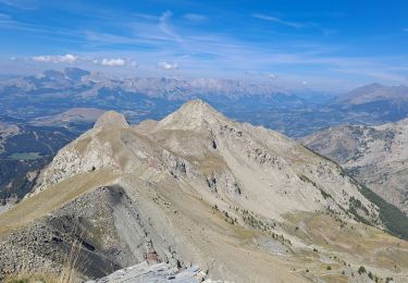
Trail Snowshoes of 14.9 km to be discovered at Provence-Alpes-Côte d'Azur, Hautes-Alpes, Ancelle. This trail is proposed by Orage.
Ski de rando.
Départ Ancelle - vallée de la Rouanne direction Haute Rouanne - laisser à gauche le rocher du Lautaret - direction les sources de la Rouanne - col de la Pourrachière - descente par le bois des Meyers - retour Ancelle par les pistes de ski de fond. Pas de difficulté majeure par beau temps mais itinéraire long.

Walking

Running

Walking
Walking
Walking
Walking

Walking
Walking
Walking