


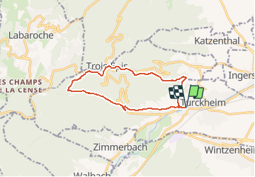

11.7 km | 17.7 km-effort


Jetz geht's wieder los, noch dem bloede COVID19


FREE GPS app for hiking
 SityTrail
IGN / Geographical institutes
SityTrail World
The world is yours!
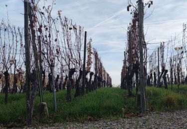
Trail Walking of 11.7 km to be discovered at Grand Est, Haut-Rhin, Turckheim. This trail is proposed by Seppala - Balades du jeudi.
Partir de Turckheim pour aller aux Trois Epis.
Dénivelé de 500 m (le matin) et 11.5 km au total.
ACCÈS :
- Turckheim, rue des Tuileries après le Monument Turenne
PARKING :
- Le long de la rue des Tuileries après le Monument Turenne
48.086019, 7.269141 ou
N 48°05'10", E 07°16'09"
RESTAURATION :
Restaurant "Le Turckheim Croix d'Or" aux Trois Epis
Tél.: 03 89 49 83 55
Walking

Walking

Walking
Walking

Mountain bike

Walking

Road bike
Walking
Walking