Trail Walking El Aserrín (Ojo de Agua del Hornito) - Aserrin 2 - Photo
© OpenStreetMap contributors
Length
Length
152 km
Max alt
Max alt
2416 m
Uphill gradient
Uphill gradient
1570 m
Km-Effort
Km-Effort  
175 km
Min alt
Min alt
1807 m
Downhill gradient
Downhill gradient
2156 m
Boucle
Boucle
No
Creation date :
2020-10-17 18:13:21.144
Updated on :
2020-10-29 18:11:51.833

(0 Reviews)

Walking
Walking
3h11
Difficulty : Very easy

Scan this QR Code to open this trail in the SityTrail application

FREE GPS app for hiking

Logo SityTrail SityTrail

IGN / Geographical institutes

Download SityTrail from the App Store Download SityTrail from Google Play

Logo SityTrail SityTrail World

The world is yours!

Download SityTrail from the App Store Download SityTrail from Google Play Download SityTrail on Huawei AppGallery

About

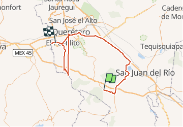
Trail Walking of 152 km to be discovered at Querétaro, Amealco de Bonfil. This trail is proposed by Adrián Torres.

Description

17 de Octubre

Elevation profile

Positioning

Country:
Mexico
Region :
Querétaro
Department/Province :
Amealco de Bonfil
Municipality :
El Aserrín (Ojo de Agua del Hornito)
Location:
Unknown
Start:(UTM)
372947 ; 2245153 (14Q) N.

Trails nearby

Trail Walking  - seevin1 - Photo
Walking
Adrián Torres

Walking

Very easy
, Michoacán, Epitacio Huerta, Mexico
9.3 km | 13.7 km-effort
3h 34min
No


Close
My subscriptions