


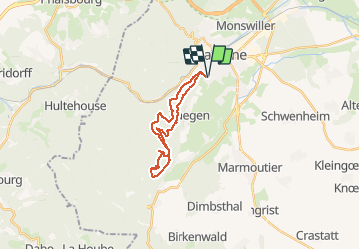


15.4 km | 19.9 km-effort

Promouvoir le Tourisme Equestre en Alsace GUIDE+


FREE GPS app for hiking
 SityTrail
IGN / Geographical institutes
SityTrail World
The world is yours!
Trail Horseback riding of 18.9 km to be discovered at Grand Est, Bas-Rhin, Saverne. This trail is proposed by Tourisme Equestre Alsace.
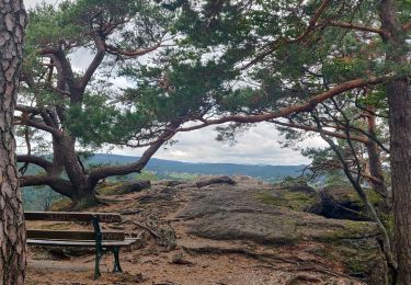
Boucle au départ et à l'arrivée de Saverne en direction du petit et du grand Geroldseck, du Haut-Barr avec une halte équestre, de la tour du Brotsch et du rocher du Hibou

Walking
Mountain bike

On foot
Walking

Walking
Walking
Walking
Walking

Walking