Trail Walking Saint-Philbert-sur-Orne - Circuit des Méandres - Photo

Circuit des Méandres

© OpenStreetMap contributors
Length
Length
13.7 km
Max alt
Max alt
163 m
Uphill gradient
Uphill gradient
337 m
Km-Effort
Km-Effort  
18.2 km
Min alt
Min alt
51 m
Downhill gradient
Downhill gradient
334 m
Boucle
Boucle
Yes
Creation date :
2016-10-12 00:00:00.0
Updated on :
2020-11-28 15:28:56.892

(0 Reviews)

Walking
Walking
2h40
Difficulty : Medium
Geocaching
Geocaching
5h00
Difficulty : Difficult

Scan this QR Code to open this trail in the SityTrail application

FREE GPS app for hiking

Logo SityTrail SityTrail

IGN / Geographical institutes

Download SityTrail from the App Store Download SityTrail from Google Play

Logo SityTrail SityTrail World

The world is yours!

Download SityTrail from the App Store Download SityTrail from Google Play Download SityTrail on Huawei AppGallery

About

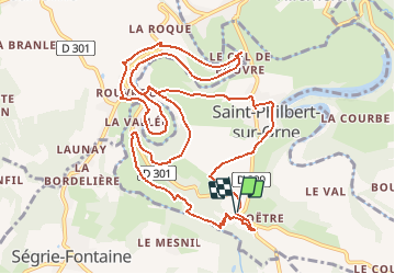
Trail Walking of 13.7 km to be discovered at Normandy, Orne, Saint-Philbert-sur-Orne. This trail is proposed by yannick-p.

Description

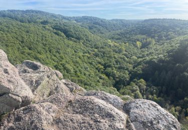
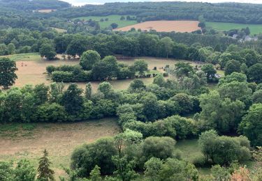
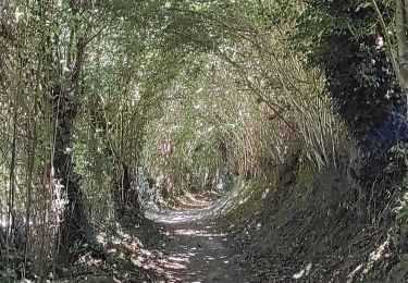
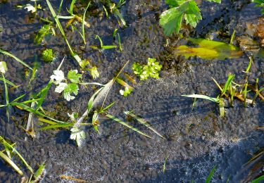
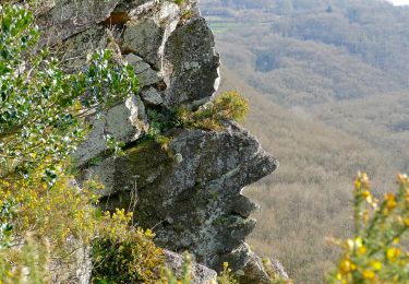
Venez découvrir les paysages époustouflants des gorges de la Rouvre et de ses méandres sur ce 2ème circuit à partir du belvédère de la Roche d'Oëtre au cœur de la Suisse Normande. En aval des gorges, cette balade de 13 kms vous révèlera ses trésors géologiques, historiques, faunistiques, floristiques et biensûr "géocachingstiques". Vous pouvez suivre le circuit que je mets en ligne avec un road book des différentes caches du parcours.

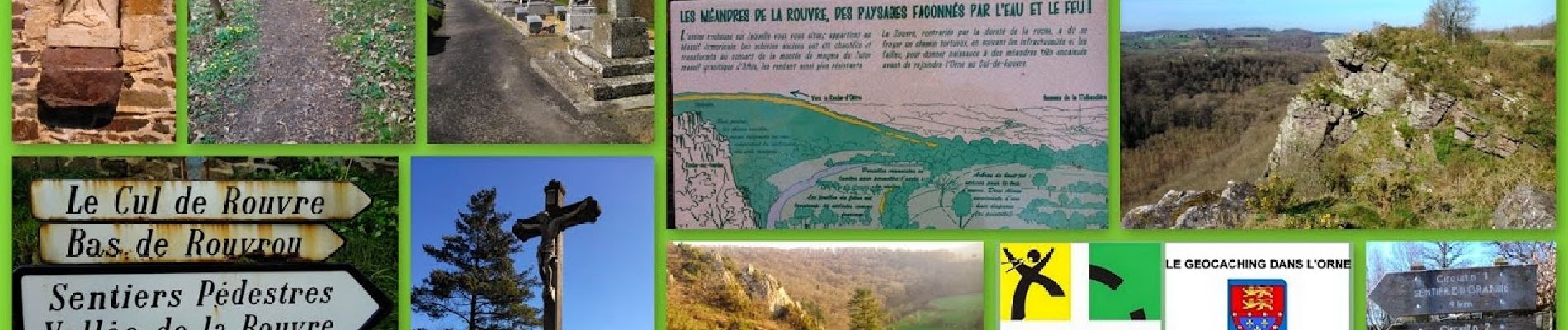
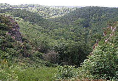
A la ?n de la période glacière, la Rouvre, large et puissante, a creusé le plateau granitique et formé les gorges que l’on connaît aujourd’hui. Bien que son lit soit plus étroit à présent, elle a conservé son caractère torrentiel.


Le circuit comprend 27 caches, dont 1 cache mystère (la Bonus) et 1 earthcache.

Bonnes recherches et bonnes découvertes !!!

https://coord.info/GC52CJ2

Elevation profile

Photos

Positioning

Country:
France
Region :
Normandy
Department/Province :
Orne
Municipality :
Saint-Philbert-sur-Orne
Location:
Unknown
Start:(UTM)
692144 ; 5411820 (30U) N.

Trails nearby

Trail Mountain bike Pont-d'Ouilly - La Petite Suisse Normande 2014 - Pont-d'Ouilly - Photo
Mountain bike
tracegps

Mountain bike

Difficult
(1)
Pont-d'Ouilly, Normandy, Calvados, France
41 km | 54 km-effort
3h 30min
Yes
Trail Walking Saint-Philbert-sur-Orne - Autour des roches d'oetre - Photo
Walking
phi14

Walking

Easy
(3)
Saint-Philbert-sur-Orne, Normandy, Orne, France
9.7 km | 12.4 km-effort
2h 30min
Yes
Trail Walking Athis-Val-de-Rouvre - Rando botanique  - Ségrie Fontaine  - Photo
Walking
tracegps

Walking

Medium
(2)
Athis-Val-de-Rouvre, Normandy, Orne, France
10.4 km | 13.4 km-effort
3h 40min
Yes
Trail Walking Saint-Philbert-sur-Orne - Roche d’oëtre sentier du Granite - Photo
Walking
zefreefly

Walking

Very easy
Saint-Philbert-sur-Orne, Normandy, Orne, France
10.1 km | 12.7 km-effort
2h 43min
Yes
Trail Walking Saint-Philbert-sur-Orne - Circuit des méandres  - Photo
Walking
JLPIERSON

Walking

Medium
Saint-Philbert-sur-Orne, Normandy, Orne, France
6.4 km | 8.4 km-effort
1h 54min
Yes
Trail Walking Ménil-Hubert-sur-Orne - De Rouvroy aux Roches d'Oetre par le sentier des Méandres  - Photo
Walking
Ecureuiltrailer

Walking

Medium
Ménil-Hubert-sur-Orne, Normandy, Orne, France
7.1 km | 9.3 km-effort
2h 1min
Yes
Trail On foot Athis-Val-de-Rouvre - Les Fontaines - Photo
On foot
PRO

On foot

Easy
Athis-Val-de-Rouvre, Normandy, Orne, France
5.7 km | 7.3 km-effort
1h 38min
Yes
Trail On foot Athis-Val-de-Rouvre - Sentier du granite - Photo
On foot
PRO

On foot

Easy
(1)
Athis-Val-de-Rouvre, Normandy, Orne, France
8.6 km | 11 km-effort
2h 30min
Yes
Trail On foot Saint-Philbert-sur-Orne - Entre Orne et Rouvre - Photo
On foot
PRO

On foot

Easy
Saint-Philbert-sur-Orne, Normandy, Orne, France
7.7 km | 10.3 km-effort
2h 19min
Yes


Close
My subscriptions