


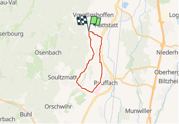
2021 Gueberschwihr Westhalten

staubalex
User

Length
16.3 km

Max alt
350 m

Uphill gradient
257 m
Km-Effort
19.8 km

Min alt
193 m

Downhill gradient
259 m
Boucle
Yes
Creation date :
2021-01-09 22:45:44.856
Updated on :
2021-01-09 22:47:37.964
2h00
Difficulty : Medium

FREE GPS app for hiking
 SityTrail
IGN / Geographical institutes
SityTrail Plus
The world is yours!
About
Trail Other activity of 16.3 km to be discovered at Grand Est, Haut-Rhin, Gueberschwihr. This trail is proposed by staubalex.
Positioning
Country:
France
Region :
Grand Est
Department/Province :
Haut-Rhin
Municipality :
Gueberschwihr
Location:
Unknown
Start:(Dec)
Start:(UTM)
371387 ; 5318214 (32U) N.
Comments