


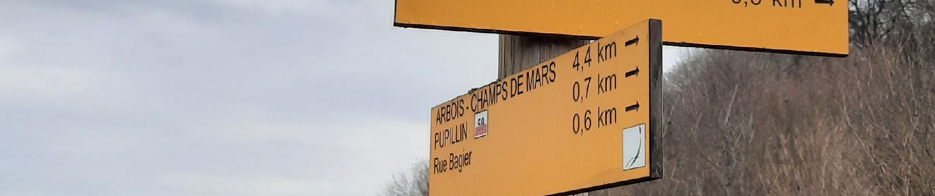
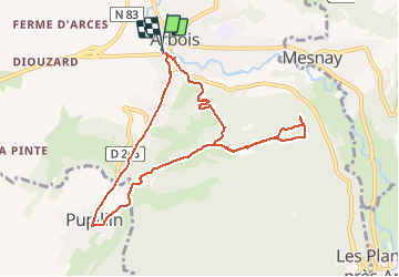
Arbois-Pupillin

Genisset
User

Length
9.3 km

Max alt
519 m

Uphill gradient
327 m
Km-Effort
13.6 km

Min alt
292 m

Downhill gradient
327 m
Boucle
Yes
Creation date :
2021-03-04 10:47:13.472
Updated on :
2021-03-04 18:58:04.083
2h27
Difficulty : Medium

FREE GPS app for hiking
 SityTrail
IGN / Geographical institutes
SityTrail Plus
The world is yours!
About
Trail Walking of 9.3 km to be discovered at Bourgogne-Franche-Comté, Jura, Arbois. This trail is proposed by Genisset.
Photos


Positioning
Country:
France
Region :
Bourgogne-Franche-Comté
Department/Province :
Jura
Municipality :
Arbois
Location:
Unknown
Start:(Dec)
Start:(UTM)
711027 ; 5197998 (31T) N.
Comments