


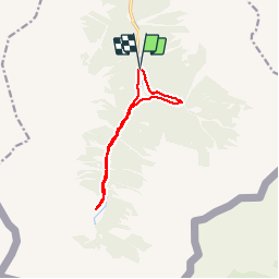

9.4 km | 13.1 km-effort


User


FREE GPS app for hiking
 SityTrail
IGN / Geographical institutes
SityTrail World
The world is yours!
Trail Walking of 10.4 km to be discovered at Occitania, Hautespyrenees, Saint-Lary-Soulan. This trail is proposed by pmp22.
Walking

Walking
Walking
Walking
Walking
Walking

On foot
On foot
On foot
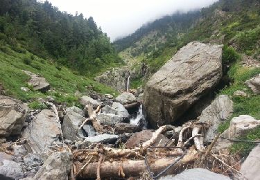
bon tracé, mais la boucle finale depuis le pont (sentier peguére) n'apporte rien de beau à voir.