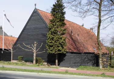
Trail Walking Rhenen - w-utrecht-elst-amerongen-leersum - Photo

w-utrecht-elst-amerongen-leersum

© OpenStreetMap contributors
Length
Length
22 km
Max alt
Max alt
79 m
Uphill gradient
Uphill gradient
202 m
Km-Effort
Km-Effort  
25 km
Min alt
Min alt
0 m
Downhill gradient
Downhill gradient
205 m
Boucle
Boucle
Yes
Creation date :
2014-12-10 00:00:00.0
Updated on :
2014-12-10 00:00:00.0

(0 Reviews)

Walking
Walking
--
Difficulty : Unknown

Scan this QR Code to open this trail in the SityTrail application

FREE GPS app for hiking

Logo SityTrail SityTrail

IGN / Geographical institutes

Download SityTrail from the App Store Download SityTrail from Google Play

Logo SityTrail SityTrail World

The world is yours!

Download SityTrail from the App Store Download SityTrail from Google Play Download SityTrail on Huawei AppGallery

About

Trail Walking of 22 km to be discovered at Utrecht, Unknown, Rhenen. This trail is proposed by gpstracks.

Description

More information on GPStracks.nl : http://www.gpstracks.nl

Elevation profile

Points of interest

Point of interest Utrechtse Heuvelrug - 02 Amerongse Berg - Photo
gpstracks
UTRECHTSE HEUVELRUG 
Point of interest Utrechtse Heuvelrug - 03 Hoogste Punt - Photo
gpstracks
UTRECHTSE HEUVELRUG 
Point of interest Utrechtse Heuvelrug - 04 Hondenasiel - Photo
gpstracks
UTRECHTSE HEUVELRUG 
Point of interest Utrechtse Heuvelrug - 05 Picnicplek - Photo
gpstracks
UTRECHTSE HEUVELRUG 
Point of interest Utrechtse Heuvelrug - 06 Restaurant pannenkoekenhuis - Photo
gpstracks
UTRECHTSE HEUVELRUG 
Point of interest Utrechtse Heuvelrug - 07 Zuilensteijn ingang - Photo
gpstracks
UTRECHTSE HEUVELRUG 
Point of interest Utrechtse Heuvelrug - 08 Picnicplek - Photo
gpstracks
UTRECHTSE HEUVELRUG 
Point of interest Utrechtse Heuvelrug - 09 Mogelijk aftakking naar uiterwaarden - Photo
gpstracks
UTRECHTSE HEUVELRUG 
Point of interest Utrechtse Heuvelrug - 10 restaurant Stallerij - Photo
gpstracks
UTRECHTSE HEUVELRUG 
Point of interest Utrechtse Heuvelrug - 11 Kasteelingang Amerongen - Photo
gpstracks
UTRECHTSE HEUVELRUG 
Point of interest Utrechtse Heuvelrug - 12 bankje uitzicht uiterwaarden - Photo
gpstracks
UTRECHTSE HEUVELRUG 
Point of interest Utrechtse Heuvelrug - 13 vogelobservatie platform - Photo
gpstracks
UTRECHTSE HEUVELRUG 
Point of interest Utrechtse Heuvelrug - 14 mogelijkheid door uiterwaarden te lopen - Photo
gpstracks
UTRECHTSE HEUVELRUG 
Point of interest Rhenen - START - Photo
gpstracks
RHENEN 

Positioning

Country:
Netherlands
Region :
Utrecht
Department/Province :
Unknown
Municipality :
Rhenen
Location:
Unknown
Start:(UTM)
670352 ; 5762900 (31U) N.

Trails nearby

Trail On foot Utrechtse Heuvelrug - Cotlandenpad - Photo
On foot
PRO

On foot

Easy
Utrechtse Heuvelrug, Utrecht, Unknown, Netherlands
9.1 km | 10 km-effort
2h 15min
No
Trail On foot Veenendaal - Groene Wissel: Veenendaal-West - Photo
On foot
PRO

On foot

Easy
Veenendaal, Utrecht, Unknown, Netherlands
6.4 km | 7.5 km-effort
1h 42min
No
Trail Walking Utrechtse Heuvelrug - Leersum doorn - Photo
Walking
tuinvrouwtje

Walking

Utrechtse Heuvelrug, Utrecht, Unknown, Netherlands
19.1 km | 23 km-effort
4h 14min
Yes
Trail Cycle Veenendaal - Utrecht - Huchiestocht - Photo
Cycle
gpstracks

Cycle

Very easy
Veenendaal, Utrecht, Unknown, Netherlands
194 km | 218 km-effort
Unknown
Yes
Trail Cycle Utrechtse Heuvelrug - f-utrecht-utrechtse-heuvelrug - Photo
Cycle
gpstracks

Cycle

Very easy
Utrechtse Heuvelrug, Utrecht, Unknown, Netherlands
63 km | 69 km-effort
Unknown
Yes
Trail Cycle Utrechtse Heuvelrug - f-utrecht-let-de-stigterpad-west-rondje - Photo
Cycle
gpstracks

Cycle

Very easy
Utrechtse Heuvelrug, Utrecht, Unknown, Netherlands
41 km | 45 km-effort
Unknown
Yes
Trail Cycle Utrechtse Heuvelrug - f-utrecht-let-de-stigterpad-oost-rondje - Photo
Cycle
gpstracks

Cycle

Very easy
Utrechtse Heuvelrug, Utrecht, Unknown, Netherlands
34 km | 38 km-effort
Unknown
Yes
Trail Cycle Utrechtse Heuvelrug - f-utrecht-heuvelrug-1 - Photo
Cycle
gpstracks

Cycle

Very easy
Utrechtse Heuvelrug, Utrecht, Unknown, Netherlands
47 km | 52 km-effort
Unknown
Yes
Trail Cycle Veenendaal - f-utrecht-gelderse-vallei - Photo
Cycle
gpstracks

Cycle

Very easy
Veenendaal, Utrecht, Unknown, Netherlands
56 km | 60 km-effort
Unknown
Yes


Close
My subscriptions