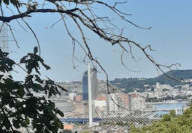
Trail Cycle Liège - f-belgie-luik-bastenaken-luik-2008 - Photo

f-belgie-luik-bastenaken-luik-2008

© OpenStreetMap contributors
Length
Length
228 km
Max alt
Max alt
651 m
Uphill gradient
Uphill gradient
4128 m
Km-Effort
Km-Effort  
283 km
Min alt
Min alt
60 m
Downhill gradient
Downhill gradient
4130 m
Boucle
Boucle
Yes
Creation date :
2014-12-10 00:00:00.0
Updated on :
2014-12-10 00:00:00.0

(0 Reviews)

Cycle
Cycle
--
Difficulty : Unknown

Scan this QR Code to open this trail in the SityTrail application

FREE GPS app for hiking

Logo SityTrail SityTrail

IGN / Geographical institutes

Download SityTrail from the App Store Download SityTrail from Google Play

Logo SityTrail SityTrail World

The world is yours!

Download SityTrail from the App Store Download SityTrail from Google Play Download SityTrail on Huawei AppGallery

About

Trail Cycle of 228 km to be discovered at Wallonia, Liège, Liège. This trail is proposed by gpstracks.

Description

More information on GPStracks.nl : http://www.gpstracks.nl

Elevation profile

Points of interest

Point of interest Vielsalm - Baraqu - Photo
gpstracks
VIELSALM 
Point of interest Bastogne - Bastog - Photo
gpstracks
BASTOGNE 
Point of interest Aywaille - La Red - Photo
gpstracks
AYWAILLE 
Point of interest Theux - La Rei - Photo
gpstracks
THEUX 
Point of interest Trois-Ponts - Wanne - Photo
gpstracks
TROIS-PONTS 
Point of interest Liège - START - Photo
gpstracks
LIÈGE 

Positioning

Country:
Belgium
Region :
Wallonia
Department/Province :
Liège
Municipality :
Liège
Location:
Liège
Start:(UTM)
682052 ; 5612089 (31U) N.

Trails nearby

Trail Walking Liège - Nuit du scoutisme -  Liège - Photo
Walking
PRO

Walking

Easy
(12)
Liège, Wallonia, Liège, Belgium
4.2 km | 6 km-effort
1h 19min
Yes
Trail Walking Liège - coteaux de la citadelle liège - Photo
Walking
jiel2

Walking

Medium
(6)
Liège, Wallonia, Liège, Belgium
14.3 km | 19.8 km-effort
7h 4min
Yes
Trail Walking Liège - GG-Lg-10_Angleur - Nessonvaux - Photo
Walking
PRO

Walking

Very difficult
(2)
Liège, Wallonia, Liège, Belgium
22 km | 32 km-effort
6h 27min
No
Trail Walking Chaudfontaine - La découverte de Sauheid et rocher du bout du monde   - Photo
Walking
GUIDE+

Walking

Medium
(1)
Chaudfontaine, Wallonia, Liège, Belgium
7.8 km | 10.2 km-effort
2h 18min
Yes
Trail Walking Liège - 2021-03-07_15h45m11_1615128300605_UnnMrtGYyrs - Photo
Walking
Mudry

Walking

Easy
(1)
Liège, Wallonia, Liège, Belgium
3 km | 3.9 km-effort
53min
Yes
Trail Walking Chaudfontaine - A la découverte des Thermes et Coteaux: La Chapelle St Anne - Photo
Walking
PRO

Walking

Medium
(1)
Chaudfontaine, Wallonia, Liège, Belgium
7.2 km | 10.4 km-effort
2h 12min
Yes
Trail Walking Liège - SART TILMAN - Photo
Walking
gorda

Walking

Easy
(2)
Liège, Wallonia, Liège, Belgium
3.6 km | 4.3 km-effort
1h 13min
Yes
Trail Walking Liège - Angleur au fil de l'eau - Photo
Walking
albert318

Walking

Very easy
(1)
Liège, Wallonia, Liège, Belgium
5.9 km | 6.5 km-effort
1h 29min
Yes
Trail Walking Liège - angleur . bois st Jacques . sart tilman . bois st laurent . angleur  - Photo
Walking
stef789

Walking

Very easy
(4)
Liège, Wallonia, Liège, Belgium
10.9 km | 14.1 km-effort
2h 40min
Yes


Close
My subscriptions