Trail Motor Le Valtin - a-frankrijk-rondrit-vogezen - Photo

a-frankrijk-rondrit-vogezen

© OpenStreetMap contributors
Length
Length
314 km
Max alt
Max alt
1351 m
Uphill gradient
Uphill gradient
26377 m
Km-Effort
Km-Effort  
668 km
Min alt
Min alt
298 m
Downhill gradient
Downhill gradient
27217 m
Boucle
Boucle
No
Creation date :
2014-12-10 00:00:00.0
Updated on :
2014-12-10 00:00:00.0

(0 Reviews)

Motor
Motor
--
Difficulty : Unknown

Scan this QR Code to open this trail in the SityTrail application

FREE GPS app for hiking

Logo SityTrail SityTrail

IGN / Geographical institutes

Download SityTrail from the App Store Download SityTrail from Google Play

Logo SityTrail SityTrail World

The world is yours!

Download SityTrail from the App Store Download SityTrail from Google Play Download SityTrail on Huawei AppGallery

About

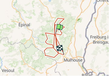
Trail Motor of 314 km to be discovered at Grand Est, Vosges, Le Valtin. This trail is proposed by gpstracks.

Description

More information on GPStracks.nl : http://www.gpstracks.nl

Elevation profile

Points of interest

Point of interest Uffholtz - Start - Photo
gpstracks
UFFHOLTZ 
Point of interest Uffholtz - V101 Uffholz - Photo
gpstracks
UFFHOLTZ 
Point of interest Soultz-Haut-Rhin - V102 Col Arnic - Photo
gpstracks
SOULTZ-HAUT-RHIN 
Point of interest Soultz-Haut-Rhin - V103 Grand Ballon - Photo
gpstracks
SOULTZ-HAUT-RHIN 
Point of interest Ranspach - V104 Le Markstein - Photo
gpstracks
Point of interest Le Valtin - V105 Col de Schlucht D430 - Photo
gpstracks
Point of interest Munster - V201 Stosswihr - Photo
gpstracks
Point of interest Hohrod - V202 Collet du Linge - Photo
gpstracks
Point of interest Orbey - V203 Col du Wettstein - Photo
gpstracks
Point of interest Orbey - V204 Orbey Pairis - Photo
gpstracks
Point of interest Lapoutroie - V205 Hachimette - Photo
gpstracks
LAPOUTROIE 
Point of interest Le Bonhomme - V207 Le Bonhomme - Photo
gpstracks
LE BONHOMME 
Point of interest Le Bonhomme - V208  N415 - Photo
gpstracks
LE BONHOMME 
Point of interest La Croix-aux-Mines - V301 D148 Route Des Crêtes - Photo
gpstracks
LA CROIX-AUX-MINES 
Point of interest Sainte-Marie-aux-Mines - V302 Sainte-Marie-aux-Mines - Photo
gpstracks
SAINTE-MARIE-AUX-MINES 
Point of interest Bertrimoutier - V303 Ban-de-Laveline - Photo
gpstracks
BERTRIMOUTIER 
Point of interest Fraize - V304 Fraize - Photo
gpstracks
FRAIZE 
Point of interest Le Valtin - V305 D23 H Le Collet - Photo
gpstracks
Point of interest Gérardmer - V401 Lac de Gérardmer - Photo
gpstracks
Point of interest La Bresse - V402 La Bresse - Photo
gpstracks
LA BRESSE 
Point of interest Cornimont - V403 Cornimont - Photo
gpstracks
CORNIMONT 
Point of interest Kruth - V404 Kruth - Photo
gpstracks
KRUTH 
Point of interest Fellering - V405 Fellering - Photo
gpstracks
FELLERING 
Point of interest Bussang - V501 Bussang - Photo
gpstracks
BUSSANG 
Point of interest Saint-Maurice-sur-Moselle - V502 St-Maurice-sur-Moselle - Photo
gpstracks
SAINT-MAURICE-SUR-MOSELLE 
Point of interest Lepuix - V503 Ballon d'Alsace - Photo
gpstracks
Point of interest Lepuix - V504 Keerpunt D465 - Photo
gpstracks
Point of interest Sewen - V505 D59 - Photo
gpstracks
SEWEN 
Point of interest Masevaux-Niederbruck - V506 Massevaux - Photo
gpstracks
MASEVAUX-NIEDERBRUCK 
Point of interest Bitschwiller-lès-Thann - V507 Bitschwiller-Les-Thann - Photo
gpstracks
BITSCHWILLER-LÈS-THANN 
Point of interest Cernay - V508 Cernay - Photo
gpstracks
CERNAY 
Point of interest Le Valtin - VBP 001 - Photo
gpstracks
LE VALTIN 
Point of interest Plainfaing - VBP 002 - Photo
gpstracks
PLAINFAING 
Point of interest Le Bonhomme - VBP 003 - Photo
gpstracks
LE BONHOMME 
Point of interest Plainfaing - VBP 004 - Photo
gpstracks
PLAINFAING 
Point of interest Plainfaing - VBP 005 - Photo
gpstracks
PLAINFAING 
Point of interest Plainfaing - VBP 006 - Photo
gpstracks
PLAINFAING 
Point of interest Xonrupt-Longemer - VBP 007 - Photo
gpstracks
XONRUPT-LONGEMER 

Positioning

Country:
France
Region :
Grand Est
Department/Province :
Vosges
Municipality :
Le Valtin
Location:
Unknown
Start:(UTM)
352658 ; 5325304 (32U) N.

Trails nearby

Trail Walking Stosswihr - Tour du belvedere avec le passage sur les crêtes  - Photo
Walking
ocepee

Walking

Very easy
(2)
Stosswihr, Grand Est, Haut-Rhin, France
8.5 km | 0 m-effort
2h 28min
Yes
Trail Other activity Soultzeren - Totom 4 lacs - Photo
Other activity
dinozore

Other activity

Medium
(1)
Soultzeren, Grand Est, Haut-Rhin, France
15.6 km | 26 km-effort
4h 37min
Yes
Trail Walking La Bresse - Les 5 lacs autour du Hohneck - Photo
Walking
tiene

Walking

Very difficult
(1)
La Bresse, Grand Est, Vosges, France
21 km | 36 km-effort
7h 21min
Yes
Trail Walking Le Valtin - Les Hirschsteine - Photo
Walking
VacheKiri67

Walking

Difficult
(1)
Le Valtin, Grand Est, Vosges, France
16.1 km | 25 km-effort
6h 28min
Yes
Trail Walking Ban-sur-Meurthe-Clefcy - La vallée de Belbriette - Ban-sur-Meurthe-Clefcy - Photo
Walking
tracegps

Walking

Medium
(2)
Ban-sur-Meurthe-Clefcy, Grand Est, Vosges, France
9.8 km | 12.6 km-effort
2h 30min
Yes
Trail Walking La Bresse - Du Hohneck au Kastelberg par les Spietzkoepfe et le Sentier des Névées - Photo
Walking
tracegps

Walking

Very difficult
(3)
La Bresse, Grand Est, Vosges, France
7.6 km | 13.7 km-effort
3h 30min
Yes
Trail Walking Soultzeren - Tanet-Gazon du faing par lac vert et retour sommet du Tanet - Photo
Walking
ride-in-Elsass

Walking

Medium
(1)
Soultzeren, Grand Est, Haut-Rhin, France
10 km | 15.6 km-effort
4h 24min
Yes
Trail Snowshoes Le Valtin - raquettes  - Photo
Snowshoes
vathi54

Snowshoes

Very easy
(1)
Le Valtin, Grand Est, Vosges, France
6.6 km | 9.4 km-effort
3h 8min
No
Trail Walking Stosswihr - Le cirque glaciaire du Frankenthal - Sentier des Roches -Gps - Photo
Walking
GUIDE
Desrumaux

Walking

Difficult
(3)
Stosswihr, Grand Est, Haut-Rhin, France
9 km | 16.1 km-effort
4h 10min
Yes


Close
My subscriptions