


Ahorn AI

furggstalden
User
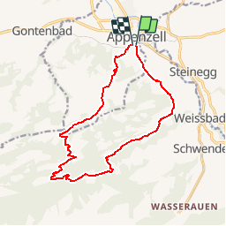

Length
14.2 km

Max alt
1281 m

Uphill gradient
648 m
Km-Effort
23 km

Min alt
786 m

Downhill gradient
649 m
Boucle
Yes
Creation date :
2014-12-11 00:00:00.0
Updated on :
2014-12-11 00:00:00.0
5h25
Difficulty : Unknown

FREE GPS app for hiking
 SityTrail
IGN / Geographical institutes
SityTrail Plus
The world is yours!
About
Trail Walking of 14.2 km to be discovered at Appenzell Innerrhoden, Unknown, Appenzell. This trail is proposed by furggstalden.
Positioning
Country:
Switzerland
Region :
Appenzell Innerrhoden
Department/Province :
Unknown
Municipality :
Appenzell
Location:
Unknown
Start:(Dec)
Start:(UTM)
530941 ; 5241720 (32T) N.
Comments