


BEYNES . chapelle S Étienne, Creisset o l

RobinMicheline
User GUIDE
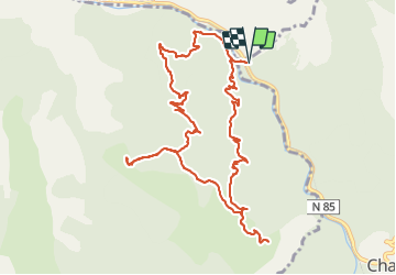

Length
13.1 km

Max alt
1154 m

Uphill gradient
635 m
Km-Effort
22 km

Min alt
636 m

Downhill gradient
632 m
Boucle
Yes
Creation date :
2021-12-02 07:44:07.852
Updated on :
2021-12-03 19:15:00.826
6h28
Difficulty : Medium

FREE GPS app for hiking
 SityTrail
IGN / Geographical institutes
SityTrail Plus
The world is yours!
About
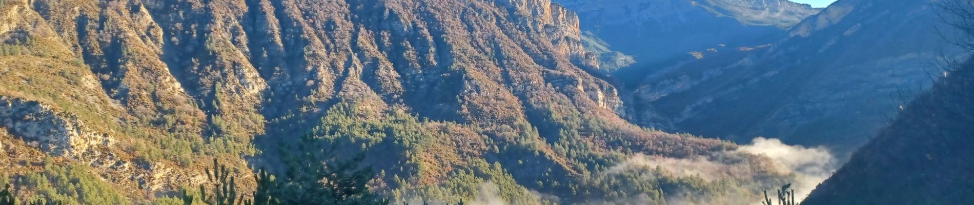
Trail Walking of 13.1 km to be discovered at Provence-Alpes-Côte d'Azur, Alpes-de-Haute-Provence, Chaudon-Norante. This trail is proposed by RobinMicheline.
Photos


Positioning
Country:
France
Region :
Provence-Alpes-Côte d'Azur
Department/Province :
Alpes-de-Haute-Provence
Municipality :
Chaudon-Norante
Location:
Unknown
Start:(Dec)
Start:(UTM)
282495 ; 4875718 (32T) N.
Comments