


cotognac

vincente204
User
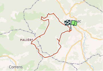

Length
18.2 km

Max alt
452 m

Uphill gradient
386 m
Km-Effort
23 km

Min alt
213 m

Downhill gradient
426 m
Boucle
Yes
Creation date :
2021-12-07 08:25:19.299
Updated on :
2021-12-07 15:04:32.077
6h36
Difficulty : Medium

FREE GPS app for hiking
 SityTrail
IGN / Geographical institutes
SityTrail Plus
The world is yours!
About
Trail Walking of 18.2 km to be discovered at Provence-Alpes-Côte d'Azur, Var, Cotignac. This trail is proposed by vincente204.
Description
facile
Positioning
Country:
France
Region :
Provence-Alpes-Côte d'Azur
Department/Province :
Var
Municipality :
Cotignac
Location:
Unknown
Start:(Dec)
Start:(UTM)
269376 ; 4822614 (32T) N.
Comments